GoFools


Canada - Montreal to Nova Scotia

05/31/2024 to 06/15/2024

We figured it was time to visit our northern neighbor, Oh Canada.

We flew into Montreal, rented a car, and headed east.

Old Quebec City for a few days, some stops in New Brunswick, then all around Nova Scotia.

The weather was not always pleasant - it is early in the season up north - but the people and scenery made up for any slight discomforts.

Wish Eastern Canada would absorb us. We could all use with a little niceness.


Old Quebec City 05/31/2024 to 06/01/2024

We headed for the old city, and it is like a little bit of France.

Not just the language, but the buildings, streets, food and service.

With 400 years of history, there is a lot to see. Oh, and the food. Amazing dishes - fresh muscles, clams, fish, veggies.


PICTURES/Old Quebec City/t_Alley of Umbrellas33.jpg
The Alley of Umbrellas. It is permanent art exhibit
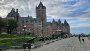
PICTURES/Old Quebec City/t_Chateau Frontenac34.jpg
Le Chateau Frontenac. Big hotel
PICTURES/Old Quebec City/t_Dufferin Terrace1.JPG
This is the Dufferin Terrace. It actually goes over the original part of the city
PICTURES/Old Quebec City/t_Dufferin Terrace Winter Slide1.jpg
Couldn't figure this out
PICTURES/Old Quebec City/t_Dufferin Terrace Winter Slide2.jpg
It's a slide for sledding in the winter
PICTURES/Old Quebec City/t_Dufferin Terrace Winter Slide4.jpg
Great idea
PICTURES/Old Quebec City/t_Crazy Staircase - accross the St. Lawrence.jpg
Looking across we saw this really crazy set of stairs. Reminded us of Cusco, Peru
PICTURES/Old Quebec City/t_Breakneck Steps33.jpg
These are called Breakneck Stairs. They're only a part of a lot of others
PICTURES/Old Quebec City/t_Stairs.JPG
Another section. We didn't photograph them all.
PICTURES/Old Quebec City/t_Funiculaire1.JPG
They have a funiculaire
PICTURES/Old Quebec City/t_George Eating Muscles.jpg
DId I mention the great food. Well, here's a little helping of muscles.
PICTURES/Old Quebec City/t_Notre Dame des Victrois.jpg
Notre-Dame des Victrois
PICTURES/Old Quebec City/t_Park34.jpg
One of the parks
PICTURES/Old Quebec City/t_philippe ramette33.jpg
So, there was a man on top of the stand with one foot hanging off. When that exhibit was done the sculputo had this - pushing the empty stand away.
PICTURES/Old Quebec City/t_Street Scene22.JPG
More great streets
PICTURES/Old Quebec City/t_Porte Saint-Louis2.JPG
Porte Saint-Louis Gate
PICTURES/Old Quebec City/t_Sharon.JPG
Yup, I'm getting ready to eat. Yes, more seafood.
PICTURES/Old Quebec City/t_Street Musician.jpg
Lots of street musicians. This man was exceptionally good


St. Martin and Fundy Parkway 06/02/2024

Left Quebec and headed through New Brunswick toward Fundy Bay.

A few stops along the way to see the sites, enjoy the landscape, and learn a little something about fossils
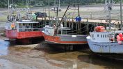


PICTURES/St. Martin and Fundy Parkway/t_Fundy Bay44.jpg
The main thing to know about Fundy bay is it has the highest and lowest tides anywhere
PICTURES/St. Martin and Fundy Parkway/t_Fundy Bay45.jpg
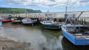
When it goes out, the boats are on the ground. If you don't make harbor in time, you anchor way, way off shore until the tide turns
PICTURES/St. Martin and Fundy Parkway/t_St. Martins - Lighthouse Visitor Center.JPG
St. Martin - Visitor Center. Once was a lighthouse but now has anotheruse
PICTURES/St. Martin and Fundy Parkway/t_St. Martin Harbor3.jpg
The harbor
PICTURES/St. Martin and Fundy Parkway/t_St. Martin - Sand Piper Gift Shop.jpg
Lots of cute little busineses. Sand Piper Gift Shop
PICTURES/St. Martin and Fundy Parkway/t_St. Martin - Whalecome .jpg
Whalecome
PICTURES/St. Martin and Fundy Parkway/t_St. Martin hip Yard Cafe.JPG
Cafe
PICTURES/St. Martin and Fundy Parkway/t_St Martins - The Caves Restaurant.jpg
THe Caves Restaurant - there is a reason for the name
PICTURES/St. Martin and Fundy Parkway/t_St. Martins - Sea Caves1.jpg
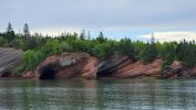
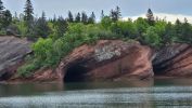
Sea caves along the cliff
PICTURES/St. Martin and Fundy Parkway/t_St. Martin - Covered Bridge2.JPG
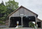
St Martin covered bridge.
PICTURES/St. Martin and Fundy Parkway/t_St. Martin - Irish River Covered Bridge5.jpg
Goes over the Irish River
PICTURES/St. Martin and Fundy Parkway/t_Moose Sculpture1.jpg
Driving along the Parkway we saw a Moose. Well, we did a u-turn
PICTURES/St. Martin and Fundy Parkway/t_Moose Sculpture4.JPG
It is a piece of art. Not sure what the frame is but the outer layer is something like heavy duty tar paper
PICTURES/St. Martin and Fundy Parkway/t_Moose Sculpture5.JPG
Realistic enough - but obviously not a danger.


Waterfalls to Fossils 06/02/2024

Moving along - so much to see.

We did a short little hike to Fuller Falls. They have a neat stair system of cables and ties - engineering ease of maintenance and replacement.

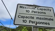
Of course we could not pass up a cable bridge with low capacity, so Cranberry Loop Trail.

Last, but definately not least, Cape Enrage where there are 320 MILLION YEAR old fossils. I swear, you can not turn over a rock without finding one. Amazing end to the day


PICTURES/Waterfalls to Fossils/t_Fuller Falls Sign2.jpg
Fuller Falls - cable steps caution
PICTURES/Waterfalls to Fossils/t_Fuller Falls - Cable Steps2.JPG
The necessary butt shot. Best to hold onto the rails because the steps do move a bit
PICTURES/Waterfalls to Fossils/t_Fuller Falls3.jpg
Fuller Falls
PICTURES/Waterfalls to Fossils/t_Cranberry Brook Loop Trail - Sign.jpg
Cranberry Brook Loop Trail - you get to cross a nice, narrow, low capacity bridge
PICTURES/Waterfalls to Fossils/t_Cranberry Loop Trail - Cable Bridge2a.JPG
No, not the big solid bridge in the foreground. That little sliver of one just below and in back of it.
PICTURES/Waterfalls to Fossils/t_Cranberry Loop Trail Cable Bridge7.jpg
It was really fun crossing it. Hate to see the back-up during the heavy tourist season
PICTURES/Waterfalls to Fossils/t_Cape Enrage1.JPG
Cape Enrage - gets its name from the large reef that extends south into Chignecto Bay, which causes the water off the point to become extremely violent, particularly at half tide when the reef is partially exposed and the water is mov
PICTURES/Waterfalls to Fossils/t_Cape Enrage2.JPG
The light house was erected in 1838
PICTURES/Waterfalls to Fossils/t_Cape Enrage - Fossil Beach1.JPG
Note the top of the sign telling you when the tides come in.
PICTURES/Waterfalls to Fossils/t_Cape Enrage - Fossil Beach4.JPG
There are always rocks falling from the cliffs
PICTURES/Waterfalls to Fossils/t_Cape Enrage - Fossil Beach5.JPG
Just a couple of the dozens of fossils we found
PICTURES/Waterfalls to Fossils/t_Cape Enrage - Fossil Beach6.JPG
Taking the tour from the geologist is worth it. We learned so much, and we could spot fossils all over


Covered Bridge, Rocks and More Fossils 06/03/2024

Our last day in New Brunswick and moving into Nova Scotia.

First, the covered bridge. Yes, we do love these things and make detours to them whenever we find them.

Then on to Hopewell Rock Provincial Park. They have some amazing pillars and when the tide is out you can walk around them. Sadly for us, it was in.

We were here in 2007, and it has had a major upgrade since then; visitor center is now huge, walkways, landscaping. Fancy. Not sure I like it, but they did not ask us.

Last, but not least, Joggins Fossil Center in Nova Scotia.


PICTURES/Covered Bridge, Rocks and More Fossils/t_Sawmill Creek Covered Bridge6.jpg
A little history on the construction. The bridges were pre-fab
PICTURES/Covered Bridge, Rocks and More Fossils/t_Sawmill Creek Covered Bridge1.jpg
Sawmill Creak Covered Bridge
PICTURES/Covered Bridge, Rocks and More Fossils/t_Sawmill Creek Covered Bridge4.jpg
George is in for scale
PICTURES/Covered Bridge, Rocks and More Fossils/t_Sawmill Creek Covered Bridge2.jpg
I loved that sign.
PICTURES/Covered Bridge, Rocks and More Fossils/t_Sawmill Creek Covered Bridge3.jpg
The truss system fascinates me
PICTURES/Covered Bridge, Rocks and More Fossils/t_Fundy Bay12.JPG
Fundy Bay at night.
PICTURES/Covered Bridge, Rocks and More Fossils/t_Hopewell Rocks1.JPG
Now on to touristing. Hopewell Rock Park. No, this sign was not here in 2007.
PICTURES/Covered Bridge, Rocks and More Fossils/t_Hopewell Rocks5.JPG
The bay is very impressive
PICTURES/Covered Bridge, Rocks and More Fossils/t_Hopewell Rocks2.JPG
Wish the tide were out
PICTURES/Covered Bridge, Rocks and More Fossils/t_Hopewell Rocks - Tides Sign.JPG
Tidal flow is not just a nice to know. When it starts coming in, it happens quickly and gets very deep
PICTURES/Covered Bridge, Rocks and More Fossils/t_Hopewell Rocks - Flower Pot Rock Sign.JPG
The Flower Pot Rocks are one of the big attractions
PICTURES/Covered Bridge, Rocks and More Fossils/t_Hopewell Rocks - FLower Pot Rocks2.JPG
You can see why they cll them flowerpots
PICTURES/Covered Bridge, Rocks and More Fossils/t_Joggins Fossil Sign.JPG
Joggins Fossil Cliff is a UNESCO site
PICTURES/Covered Bridge, Rocks and More Fossils/t_Joggins Fossil Beach8.JPG
The beach, lots of rocks from the cliffs
PICTURES/Covered Bridge, Rocks and More Fossils/t_Joggins Fossil Beach12.JPG
Some various fossils. I can not remember what each is, but they're mostly flora
PICTURES/Covered Bridge, Rocks and More Fossils/t_Joggins Fossil Beach18.JPG
You can see a tree in this one
PICTURES/Covered Bridge, Rocks and More Fossils/t_Joggins Fossil Beach21.JPG
Those striped areas are old deposits
PICTURES/Covered Bridge, Rocks and More Fossils/t_Joggins Fossil Beach22.JPG
More fossils


Chignecto Park and Big Dip Park 06/04/2024

Next day we headed south along the western shore of the upper peninsula of Nova Scotia.

We had a couple places in mind, but mostly just let the whim lead us.

A little hike along the Eatonville Trail was a nice exercise, and the weather was warm, upper 70s. It changes so fast here.

The next stop was someplace we can not remember the name of, but since it was down in a valley, I will just call it Big Dip Park. Some really nice rocks here.


PICTURES/Chignecto Park and  Big Dip Park/t_Cape Chignecto - Andersons Cove - Eatonville Harbor Sign.JPG
A little history of the Eatonville Harbor
PICTURES/Chignecto Park and  Big Dip Park/t_Cape Chignecto - Andersons Cove - Eatonville Harbor2.JPG
The harbor as it is today.
PICTURES/Chignecto Park and  Big Dip Park/t_Cape Chignecto - Eatonville Town Picture.jpg
And as it looked in it's hayday
PICTURES/Chignecto Park and  Big Dip Park/t_Cape Chignecto - Andersons Cove3.JPG
The cove near the harbor
PICTURES/Chignecto Park and  Big Dip Park/t_Cape Chignecto - Eatonville Trail - 3 Sisters.JPG
Unfortunately you can not see the 3rd sister from the vantae point. Maybe just the tip of it in the background
PICTURES/Chignecto Park and  Big Dip Park/t_Cape Chignecto - Eatonville Trail Sea Stack2.JPG
Sea Stacks - formations found all along the Oregon coast and here
PICTURES/Chignecto Park and  Big Dip Park/t_Big Dip Beach - Artsy Shot4A.jpg
Big Dip Beach - we just named it
PICTURES/Chignecto Park and  Big Dip Park/t_Big Dip Beach - Artsy Shot2.jpg
Artsy shot
PICTURES/Chignecto Park and  Big Dip Park/t_Big Dip Beach27.jpg
We walked over to those cliffs
PICTURES/Chignecto Park and  Big Dip Park/t_Big Dip Beach13.JPG
Heather, I am always so glad you made me that headband
PICTURES/Chignecto Park and  Big Dip Park/t_Big Dip Beach42.jpg
Pretty amazing rocks
PICTURES/Chignecto Park and  Big Dip Park/t_Big Dip Beach Seaweed5.JPG
Seaweed
PICTURES/Chignecto Park and  Big Dip Park/t_Big Dip Beach Seaweed8.JPG
It looks like something from a horror movie slowly eating up the rocks
PICTURES/Chignecto Park and  Big Dip Park/t_Big Dip Beach Seaweed11.JPG
Partially consumed rock


Driftwood Beach and Cape D'Or 06/04/2024

Meandering along the coast toward Advocate Bay, we stopped at Driftwood Beach.

For some reason, the currents and high tides conspire to dump driftwood along this stretch of beach. Very impressive.

After our stroll among the bleached wood, we headed to Cape D'Or, our destination for tonight.

The lighthouse still functions. The Lightkeeper's home is a B&B, not plush but very clean. Best of all, Darcey, the owner. Such a wonderful host.


PICTURES/Driftwood Beach and Cape D'Or/t_Driftwood Beach3a.jpg
Apparently they have to clear it from the road at times
PICTURES/Driftwood Beach and Cape D'Or/t_Driftwood Beach31.JPG
Woodowrkers paradise
PICTURES/Driftwood Beach and Cape D'Or/t_Driftwood Beach25.JPG
Once you get over the wood piles, without twisting an ankle, it is a lovely beach
PICTURES/Driftwood Beach and Cape D'Or/t_Shadow People on Driftwood Beach3.JPG
Even the Shadow People came to enjoy. Haven't seen them for decades
PICTURES/Driftwood Beach and Cape D'Or/t_Cape D'Or Buildings1.JPG
Cape D'Or Lighthouse, lightkeepers house and restaurant. The drive down is steep and very rocky
PICTURES/Driftwood Beach and Cape D'Or/t_Cape D'Or Lighthouse2a.JPG
The grounds are lovely, very peaceful
PICTURES/Driftwood Beach and Cape D'Or/t_Cape D'Or Lighthouse1.JPG
The lighthouse
PICTURES/Driftwood Beach and Cape D'Or/t_Cape D'Or1.JPG
Beautiful look at Fundy Bay
PICTURES/Driftwood Beach and Cape D'Or/t_Cape D'Or Buildings6.JPG
As the sunsets
PICTURES/Driftwood Beach and Cape D'Or/t_Cape D'Or Lighthouse6.JPG
Again, a different look at dusk
PICTURES/Driftwood Beach and Cape D'Or/t_Cape D'Or Lighthouse5.JPG
We took a break from dinner, between salad and entree, becuase Darcey said we needed to see the sunset
PICTURES/Driftwood Beach and Cape D'Or/t_Cape D'Or Lighthouse11.JPG
The lighthouse still does it's job. Here the light is strobbing
PICTURES/Driftwood Beach and Cape D'Or/t_Cape D'Or30.JPG
Can not beat this place for beauty


Burntcoat Head Park and Walton Lighthouse 06/05/2024

As we round the corner and start heading north along the eastern coast of Nova Scotia, we made a couple little stops to break up the drive.

Burntcoat Head Park - named because a man put his coat on fire placing a lit pipe in the pocket - had a restored lighthouse and a huge park.

The lighthouse was pulled down in 1972, but a dedicated group of people worked to get a replica built on site


PICTURES/Burntcoat Head Park and Walton Lighthouse/t_Burntcoat Head Park Sign.JPG
Highest and lowest tides on Fundy Bay. The park is fairly large and lots of folks having picnics, strolling, playing with kids
PICTURES/Burntcoat Head Park and Walton Lighthouse/t_Burl Sign.jpg
A brief descriptions of spruce burls
PICTURES/Burntcoat Head Park and Walton Lighthouse/t_Burl2.jpg
And an excellent example of said burls
PICTURES/Burntcoat Head Park and Walton Lighthouse/t_Burntcoat Head Park.JPG
Andirondack chairs are very popular up here. You see a lot of them, all brightly painted.
PICTURES/Burntcoat Head Park and Walton Lighthouse/t_Burntcoat Head Park2.JPG
Bay of Fundy. Yes, the same bay as in all the other shots. It is a huge bay
PICTURES/Burntcoat Head Park and Walton Lighthouse/t_Burntcoat Head Park3.JPG
My outfit says all you need to know about the weather. Had to shed 2 layers in 20 minutes.
PICTURES/Burntcoat Head Park and Walton Lighthouse/t_Burntcoat Head Park6.JPG
The colors of the coastline are spectacular
PICTURES/Burntcoat Head Park and Walton Lighthouse/t_Burntcoat Head Park7.JPG
Yes, me taking a picture of George, who is taking a picture of me
PICTURES/Burntcoat Head Park and Walton Lighthouse/t_Burntcoat Head Park30.jpg
My shot of George. I insist on a few so you know he actually was on the trip
PICTURES/Burntcoat Head Park and Walton Lighthouse/t_Walton Lighthouse Sign.jpg
Walton Lighthouse. A rich Arcadian history
PICTURES/Burntcoat Head Park and Walton Lighthouse/t_Walton Lighthouse4.JPG
It is a bit small, but we love the view
PICTURES/Burntcoat Head Park and Walton Lighthouse/t_Walton Lighthouse10.jpg
I saw this as we were coming down. Too busy watching my feet and ducking to notice going up
PICTURES/Burntcoat Head Park and Walton Lighthouse/t_Walton Lighthouse12.jpg
The light


Cape Forchu 06/06/2024

Cape Forchu has one of the most unique lighthouses we have seen.

The original one was the traditional square, tapered wooden structure that got pretty well beaten up by the weather.

It was replaced in 1962 with this "apple core" concrete design. The taper allows wind to go around it instead of battering it to pieces.

There is also Lief Erikson park below the lighthouse. It seems a favorite walking trail for locals and their pets.

Oh, and of course, Foggy the Fin Whale


PICTURES/Cape Forchu/t_Cape Forchu - Roadway Sights1.JPG
The drive along the coast to Cape Forchu lighthouse is quite interesting
PICTURES/Cape Forchu/t_Cape Forchu - Roadway Sights4.jpg
Since it is an active fishing town, I am sure all these things have purpose
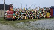
PICTURES/Cape Forchu/t_Cape Forchu - Roadway Bouy3.jpg
Bouys - lots and lots of bouys
PICTURES/Cape Forchu/t_Cape Forchu - Roadway Bouys2.JPG
Like a colorful mozaic
PICTURES/Cape Forchu/t_Cape Forchu Lighthouse Sign.JPG
The lighthouse
PICTURES/Cape Forchu/t_Lighthouse9.jpg
THey encourage you to Climb the lighthouse - with a guide of course
PICTURES/Cape Forchu/t_Lighthouse2.JPG
You can see the lighthouse is quite unique
PICTURES/Cape Forchu/t_Cape Forchu - Lighthouse Stairs5.JPG
Climbing the stairs up
PICTURES/Cape Forchu/t_Cape Forchu Lighthouse Lamp1.JPG
The light
PICTURES/Cape Forchu/t_Cape Forchu Lighthouse Lamp2.JPG
Our guide was kind enough to turn it on briefly for us.
PICTURES/Cape Forchu/t_Foggy The Whale21.JPG
Along the walkway we saw this down below and could not figure out what it was
PICTURES/Cape Forchu/t_Cape Forchu Lighthouse17.jpg
When we exited the fog had moved in
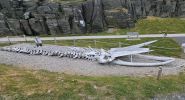
PICTURES/Cape Forchu/t_Foggy Fin Whale Sign.JPG
The thing we saw from the tower was Foggy the Fin Whale
PICTURES/Cape Forchu/t_Foggy The Whale2.jpg
It may be as close as I will ever get to a whale
PICTURES/Cape Forchu/t_Cape Forchu Beach5.JPG
Down at the beach in Erikson
PICTURES/Cape Forchu/t_Cape Forchu Beach Town Signs.jpg
Canadians have a great sense of humor


Lunenburg and Peggys Cove 06/07/2024

We we visited 2 rather unique places.

Lunenburg, which was founded in 1753, is the best example of a planned British colonial town with a grid street system.

Today it has most of the same appearance and layout as then. About 70% of the buildings are original.

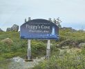
Peggys Cove is just south of Halifax. There are several theories on how it was named.

In 1766 Samuel de Champlain named the bay Saint Margaret in honor of his mother, Marguerite le Roy. Peggy is a nickname for Marguerite.

However, folklore claims the name came from the sole survivor of a shipwreck at Halibut Rock near the cove. Her name was Peggy


PICTURES/Lunenburg and Peggys Cove/t_Ludenburg - Bluenose1a.JPG
Bluenose II - built in 1962 to replace the original undefeated racing schooner BluenoseI
PICTURES/Lunenburg and Peggys Cove/t_Ludenburg - Bluenose4.JPG
As with all these great schooners, the construction is a piece of art
PICTURES/Lunenburg and Peggys Cove/t_Ludenburg - Gray Bldg.jpg
Some of the small fishing sheds
PICTURES/Lunenburg and Peggys Cove/t_Ludenburg - Street Scene.JPG
As with so much of Nova Scotia, colors are bold
PICTURES/Lunenburg and Peggys Cove/t_Lunenburg - Green Bldg.jpg
Originally captains painted their houses the same as their ships for easy identification
PICTURES/Lunenburg and Peggys Cove/t_Ludenburg - white Bldg.jpg
More fishing sheds
PICTURES/Lunenburg and Peggys Cove/t_Lundenburg - Bank of Montreal.jpg
Bank of Montreal
PICTURES/Lunenburg and Peggys Cove/t_Lunenburg - Adams & Knickle.jpg
Adams & Knickle - once processed fish now it's scallops
PICTURES/Lunenburg and Peggys Cove/t_Peggys Cove - Lighthouse14.JPG
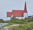
The lighthouse at Peggys Cove
PICTURES/Lunenburg and Peggys Cove/t_Peggys Cove - Harbor Shots (1).JPG
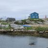
In town, looking at the harbor
PICTURES/Lunenburg and Peggys Cove/t_Peggys Cove - Harbor Shots (4).JPG
It is a rather busy area, lots of boats and equipment
PICTURES/Lunenburg and Peggys Cove/t_Peggys Cove - Harbor Shots (6).JPG
This is a makeral boat
PICTURES/Lunenburg and Peggys Cove/t_Peggys Cove - Lobster Line.jpg
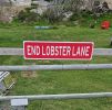
In case the lack of pavement and a fence did not give you a hint the road ended, they have a sign
PICTURES/Lunenburg and Peggys Cove/t_Peggys Cove - Colorful Chairs (1).JPG
Canadians do love their colorful chairs
PICTURES/Lunenburg and Peggys Cove/t_Peggys Cove - Colorful Chairs (3).JPG
We are several weeks out from the real summer season, so these are just waiting to be enjoyed by weary visitors


Halifax - Georges Island and Maritime Museum 06/08/2024

We did a lot of walking around Halifax, but did not seem to have taken many pictures. Odd.

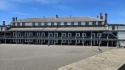
We did take quite a few of Georges Island and Fort Charlotte. Built around 1749 and active up until after WWII, it is now a National Historic Site and part of the Canadian Parks system.

The Maritime Museum was a very nice find. The area is rich in history, mostly associated with the sea, so why not take time to enjoy a nice presentation of various maritime exhibits.


PICTURES/Halifax - Georges Island and Maritime Museum/t_George Island From Boat (3).JPG
Georges Island - short ferry ride from Halifax pier
PICTURES/Halifax - Georges Island and Maritime Museum/t_Halifax From Boat4.JPG
Looking ack at the Halifax skyline from the ferry
PICTURES/Halifax - Georges Island and Maritime Museum/t_Halifax From Georges Island1.JPG
You can see it is not far from the city to the fort
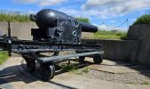
PICTURES/Halifax - Georges Island and Maritime Museum/t_Georges Island - Fort Charlotte Cannon (4).JPG
We had never seen cannon like these
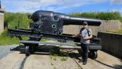
PICTURES/Halifax - Georges Island and Maritime Museum/t_Georges Island - Fort Charlotte Cannon (5).JPG
Our guide is with the Canadian Parks service, dressed in WWII uniform
PICTURES/Halifax - Georges Island and Maritime Museum/t_Georges Island - Fort Charlotte Lighthouse1.JPG
The lighthouse
PICTURES/Halifax - Georges Island and Maritime Museum/t_Georges Island - Fort Charlotte Moat (4).jpg
Our guide explaining about the drainage system
PICTURES/Halifax - Georges Island and Maritime Museum/t_Georges Island - Fort Charlotte Moat (9).JPG
And that is the moat and drains
PICTURES/Halifax - Georges Island and Maritime Museum/t_Georges Island - Fort Charlotte Moat (10).JPG
The use of brick as the arch is for structural reasons, but I think it is quite decorative
PICTURES/Halifax - Georges Island and Maritime Museum/t_Georges Island - Fort Charlotte Powder Room2.JPG
Powder room. They always have thar domed ceiling
PICTURES/Halifax - Georges Island and Maritime Museum/t_Georges Island - Fort Charlotte Ramparts1.JPG
Ramparts
PICTURES/Halifax - Georges Island and Maritime Museum/t_Georges Island - Fort Charlotte Powder Room4.JPG
Heading out to walk around
PICTURES/Halifax - Georges Island and Maritime Museum/t_Georges Island - Fort Charlotte Colorful Chairs.JPG
Yes, colorful chairs.
PICTURES/Halifax - Georges Island and Maritime Museum/t_Georges Island - Submarine Mine.jpg
Anti-submarine Mine
PICTURES/Halifax - Georges Island and Maritime Museum/t_Halifax - Halifax Pier.jpg
Back in Halifax - standing on the pier, humming Barrets Privateers.
PICTURES/Halifax - Georges Island and Maritime Museum/t_Halifax - Best Sign.jpg
Such wisdom in a sign
PICTURES/Halifax - Georges Island and Maritime Museum/t_Halifax - Maritime Museum of the Atlantic sign.jpg
Maritime Museum
PICTURES/Halifax - Georges Island and Maritime Museum/t_Halifax - Sailor Statue.jpg
Statue to sailors


Halifax Citadel 06/09/2024

On a high hill in Halifax a fort was built in 1749. Since then it has had 3 upgrades in reaction to numerous wars.

In 1956 it was opened as an historic site and tourist destination.

As with all Parks in Canada it is a living history museum and guides were historically correct costumes.

To reach the fort you walk up a nice, path surrounded by grass and flowers, passing the Clock Tower built in 1803 and still working today.

There is also a creative exhibit dedicated to the 75th anniversary of D-Day landing.

And, if you know us, you are prepared for a lot of pictures of ramparts, cannon, and all things fort related


PICTURES/Halifax Citadel/t_Halifax - Old Clock Tower (3).JPG
Clock Tower - still working
PICTURES/Halifax Citadel/t_Citadel Walkway1.JPG
What a difference a day makes.
PICTURES/Halifax Citadel/t_Citadel  Walkway2.JPG
Today sunny and bright
PICTURES/Halifax Citadel/t_Citadel Walkway4.JPG
Guard at the entrance.
PICTURES/Halifax Citadel/t_Citadel Walkway4a.JPG
They take this part seriously
PICTURES/Halifax Citadel/t_Cannon Hoist2 (1).JPG
Cannon hoist
PICTURES/Halifax Citadel/t_Door.jpg
Some of the door lables
PICTURES/Halifax Citadel/t_Elevator Shed.jpg
Now what could this be
PICTURES/Halifax Citadel/t_Elevator.jpg
An elevator building of course.
PICTURES/Halifax Citadel/t_Halifax Citidel - Enlisted Quarters12.jpg
Enlisted mens barracks
PICTURES/Halifax Citadel/t_Guard House.jpg
Guard ower
PICTURES/Halifax Citadel/t_Musket Fire Demo (4).JPG
Our guide - one of the 78th Highland Regiment.
PICTURES/Halifax Citadel/t_Musket Fire Demo (6).JPG
Live musket fire demo
PICTURES/Halifax Citadel/t_Musket Fire Demo (10).jpg
Reload - well trying to. It is jammed
PICTURES/Halifax Citadel/t_Musket Fire Demo (13).jpg
But never fear, they have honest to goodness experts on hand
PICTURES/Halifax Citadel/t_Cannon Firing Team2.JPG
Now for the live firing of the cannon
PICTURES/Halifax Citadel/t_Cannon Live Fire (8).JPG
Each day at noon. Notice the spotter on the top
PICTURES/Halifax Citadel/t_Powder Kegs3.JPG
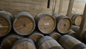
Powder kegs - replicas of course
PICTURES/Halifax Citadel/t_Powder Kegs8.jpg
Those letters have meaning.
PICTURES/Halifax Citadel/t_Soldier With Drum1.JPG
Soldier carrying a drum on his back
PICTURES/Halifax Citadel/t_Wild Parsnips Warning.jpg
Never knew wild parsnips were dangerous
PICTURES/Halifax Citadel/t_Mess.JPG
Enlisted mess
PICTURES/Halifax Citadel/t_Mess2.JPG
Officers mess
PICTURES/Halifax Citadel/t_D-Day Beach2.jpg
D-Day recreation of the beach landing
PICTURES/Halifax Citadel/t_D-Day Beach3.jpg
It was very well done.
PICTURES/Halifax Citadel/t_D-Day Beach6.jpg
Even a landing craft


Halifax Prince of Wales Tower 06/09/2024

This is the oldest martello tower in North America, and the last remaining one in Halifax.

There are a score or more scattered around the British Empire.


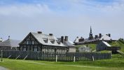
Fortress Louisbourg 06/11/2024

Heading north up the coast, the next stop was in Cape Breton area.

Fortress Louisboug was originally a French port that grew into a major fishing industry and important port.

Though the various wars between France and Britian it changed hands, once being ceded back to France as part of the treaty after The War of Austrian Succession. I'm sure we all remember that one.

Eventually the British retook it during the Seven Years War and demolished it so it could not be used again.

It was partially restored starting in 1961, using unemployed coal miners who gained new training as masons and carpenters.


PICTURES/Fortress Louisbourg/t_Ft. Louisburg - Outer View (6).JPG
Fortress Louisburg accross the bay
PICTURES/Fortress Louisbourg/t_Fort Louisburg - Outerview14.jpg
Fortress Louisburg accross the bay
PICTURES/Fortress Louisbourg/t_Ft. Louisburg - Outer View (5).JPG
Fortress Louisburg accross the bay
PICTURES/Fortress Louisbourg/t_Ft. Louisburg - Outer View (1).JPG
Fortress Louisburg accross the bay
PICTURES/Fortress Louisbourg/t_Ft. Louisburg - Outer View (7).JPG
Fortress Louisburg accross the bay
PICTURES/Fortress Louisbourg/t_Rue Toulouse1.JPG
Main street - Rue Toulouse
PICTURES/Fortress Louisbourg/t_Sheep3.JPG
The sheep pens are just off the main street. Yes, they do herd them through town.
PICTURES/Fortress Louisbourg/t_Sheep2.JPG
Sheering was to happen the following week. Bummer.
PICTURES/Fortress Louisbourg/t_Buildings & Fort.jpg
Some of the reconstructed buildings
PICTURES/Fortress Louisbourg/t_Buildings8.JPG
The archeologists, scientists, park service did extensive research
PICTURES/Fortress Louisbourg/t_Kings Storehouse3.JPG
Kings Storehouse
PICTURES/Fortress Louisbourg/t_Frederic Gate2.JPG
Frederic Gate
PICTURES/Fortress Louisbourg/t_Frederic Gate3a.JPG
Note the wooden wall - wood over stone
PICTURES/Fortress Louisbourg/t_Fort Frontyard.JPG
The Fort. The guardhouse is to the right.
PICTURES/Fortress Louisbourg/t_Guardroom Beds1.JPG
Beds in the guardhouse.
PICTURES/Fortress Louisbourg/t_Fort Entrance3.JPG
Entrance
PICTURES/Fortress Louisbourg/t_Fort Entrance4.JPG
No idea what I'm signing about there
PICTURES/Fortress Louisbourg/t_Guard.jpg
One of the guards in period dress
PICTURES/Fortress Louisbourg/t_Chapel3.JPG
The chapel
PICTURES/Fortress Louisbourg/t_Chapel - chandelier.jpg
I loved the detail right down to the chandelier
PICTURES/Fortress Louisbourg/t_Chapel5.jpg
Confessional
PICTURES/Fortress Louisbourg/t_Parade Grounds2.JPG
The one building housed enlisted as well as the Governors quarters
PICTURES/Fortress Louisbourg/t_Fort Clocktower.jpg
Clocktower from the rear
PICTURES/Fortress Louisbourg/t_Barricks & Garden3.JPG
Quite a parade ground
PICTURES/Fortress Louisbourg/t_Barricks & Garden.jpg
Up on the ramparts lookng at the barricks and the garden/animal enclosure
PICTURES/Fortress Louisbourg/t_Chickens1.JPG
The animal yard has chickens geese, and a couple turkeys
PICTURES/Fortress Louisbourg/t_Front Gate Bridge.JPG
Front gate bridge
PICTURES/Fortress Louisbourg/t_Front Gatehouse.JPG
Gatehouse
PICTURES/Fortress Louisbourg/t_Cannon4.jpg
Cannon - but you figured that out yourself didn' you
PICTURES/Fortress Louisbourg/t_Town From Ramparts.JPG
Looking at the town from the ramparts
PICTURES/Fortress Louisbourg/t_Enlisted Bunks.JPG
Enlisted bunkhouse
PICTURES/Fortress Louisbourg/t_Governors Quarters7.JPG
Up the stairs to the private part of the Governors quarters
PICTURES/Fortress Louisbourg/t_Governors Quarters4.JPG
Cards were big
PICTURES/Fortress Louisbourg/t_Governors Quarters1.JPG
Dinning room
PICTURES/Fortress Louisbourg/t_Governors Kitchen7.JPG
Governors Kitchen
PICTURES/Fortress Louisbourg/t_Storage3.JPG
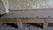
Storage, and where soldiers going home were housed
PICTURES/Fortress Louisbourg/t_Prisoner Bed1.jpg
Also the prisoners
PICTURES/Fortress Louisbourg/t_Wall & Kings Storehouse.JPG
The wall is pretty amazing


Cabot Trail - Coves, Forests, Trails and Falls 06/12/2024 to 06/13/2024

Cabot Trail is really the road that goes around and into Cape Breton Highland National Park.

We opted for a few short hikes to get a nice overview of the beautiful scenery.

This is a place you can spend a few weeks in and never get bored. Between the diversity, bays and fishing towns, to the great food and people, it is a must for anyone who wants to enjoy the great outdoors of Canada.

So, a little of this, a little of that, and some great memories


PICTURES/Cabot Trail - Coves, Forests, Trails and Falls/t_Green Cove3.JPG
As you can see, the weather changed again.
PICTURES/Cabot Trail - Coves, Forests, Trails and Falls/t_Green Cove5.JPG
But the scenery was still amazing
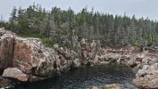
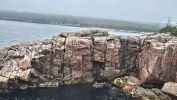
PICTURES/Cabot Trail - Coves, Forests, Trails and Falls/t_Jack Pine2.jpg
Left out all the walking through the woods
PICTURES/Cabot Trail - Coves, Forests, Trails and Falls/t_Jack Pine1.jpg
The rocks were the main attraction
PICTURES/Cabot Trail - Coves, Forests, Trails and Falls/t_Neils Harbor5.jpg
Neeils Harbor
PICTURES/Cabot Trail - Coves, Forests, Trails and Falls/t_Neils Harbor6.jpg
Another fishing village
PICTURES/Cabot Trail - Coves, Forests, Trails and Falls/t_Pleasant Bay2.JPG
PLeasant Bay - just a nice coastline shot
PICTURES/Cabot Trail - Coves, Forests, Trails and Falls/t_Road1.jpg
And a shot of the road
PICTURES/Cabot Trail - Coves, Forests, Trails and Falls/t_Beulach Ban Falls Sign2.JPG
Beulach Ban Falls
PICTURES/Cabot Trail - Coves, Forests, Trails and Falls/t_Blue Shades1.jpg
I just was blown away by the amazing colors
PICTURES/Cabot Trail - Coves, Forests, Trails and Falls/t_Fishing Cove3.jpg
Gulls, and a deep blue water
PICTURES/Cabot Trail - Coves, Forests, Trails and Falls/t_La Buttereau 6.JPG
Hiking through the woods
PICTURES/Cabot Trail - Coves, Forests, Trails and Falls/t_Lone Shieling Sign.JPG
Lone Shieling - its a recreation of a shieling. In Scottish highlands crafters (tenent farmers) grazed sheep on chieftan hills. Shielings were shelters for shepherds and flocks
PICTURES/Cabot Trail - Coves, Forests, Trails and Falls/t_Lone Shieling5.jpg
Lone Shieling with George inside
PICTURES/Cabot Trail - Coves, Forests, Trails and Falls/t_Lone Shieling Shrooms15.jpg
We finally found mushrroms.
PICTURES/Cabot Trail - Coves, Forests, Trails and Falls/t_Lone Shieling Shrooms17.jpg
It has been a mushroomless trip until now
PICTURES/Cabot Trail - Coves, Forests, Trails and Falls/t_MacIntosh Brook (1).jpg
MacIntosh Brook - George was having fun among the rocks
PICTURES/Cabot Trail - Coves, Forests, Trails and Falls/t_MacIntosh Brook14.JPG
The falls at MacIntosh Brook
PICTURES/Cabot Trail - Coves, Forests, Trails and Falls/t_Pillar Rocks4.jpg
Pillar Rocks
PICTURES/Cabot Trail - Coves, Forests, Trails and Falls/t_Pillar Rocks3.jpg
With the whitecap splashing up I was immediately thinking of whales breaching
PICTURES/Cabot Trail - Coves, Forests, Trails and Falls/t_Road.JPG
Another pretty road shot


Glenora Distillery and Inn 06/13/2024

George found this, and since we are big fans of distillery tours, especiall when they are for small facilities working to establish or restore an industry.

This one started in 1990, as the first single malt whiskey distillery in North America.

Over the years they have expanded a little, adding an Inn and Restaurant.

it was a lovely setting, and we enjoyed the dinner and the tour


PICTURES/Glenora Distillery and Inn/t_Glenora Distillery (6).JPG
Welcome to Glenora. This is a very Scottish area and proud of it's ancestory
PICTURES/Glenora Distillery and Inn/t_Glenora Distillery (1).JPG
The place is quite picturesque
PICTURES/Glenora Distillery and Inn/t_Glenora Distillery (9).JPG
Mash Tun - and our guide. He was a lot of fun
PICTURES/Glenora Distillery and Inn/t_Glenora Distillery (10).JPG
Inside the Tun. FIrst time we have seen inside one. Usually they are full of mash
PICTURES/Glenora Distillery and Inn/t_Glenora Distillery (13).JPG
The distilllers. Yes, they came from Scotland.


Montreal - Harbor Sight Seeing 06/15/2024

Drove back to Montreal from Cape Breton - 2 days of driving accross New Brunswick. It is a big country.

We decided a nice day in Montreal was a good idea before we headed home. We put almost 4,000 miles on that rental

We wandered around, saw some sites, had some great food, revisited some history, and had a lovely last day.


PICTURES/Montreal - Harbor Sight Seeing/t_DSC02274.JPG
I liked the idea of reusing cargo containers as stores. It was early on Sunday so most were not open
PICTURES/Montreal - Harbor Sight Seeing/t_Wheel13.JPG
Le Grande Roue de Montreal - big ferris wheel
PICTURES/Montreal - Harbor Sight Seeing/t_Cirque de Soleil - From Wheel.jpg
Cirque du Soleil - the international headquarters and training facility are here
PICTURES/Montreal - Harbor Sight Seeing/t_WHeel11.JPG
Some nice views from the cabin. We had it all to ourselves, since crowds are thin this time of year
PICTURES/Montreal - Harbor Sight Seeing/t_Bonsecours Market From Wheel.JPG
The long building is Bonsecours Market - a huge market of vendors, foods, etc.
PICTURES/Montreal - Harbor Sight Seeing/t_Harbor From Wheel6.JPG
The harbor
PICTURES/Montreal - Harbor Sight Seeing/t_Harbor From Wheel7.JPG
That big globe out in the distance is the biosphere museum from the 1967 World Expo held in Montreal
PICTURES/Montreal - Harbor Sight Seeing/t_Harbor4.JPG
The harbor is nice
PICTURES/Montreal - Harbor Sight Seeing/t_Pirate Ship from Wheel.jpg
There is a large play area near the wheel, and a pirate ship is a big part. You can see it from the wheel
PICTURES/Montreal - Harbor Sight Seeing/t_Clock Tower3.JPG
The clock tower. Unfortunately it is in bad shape and no one is allowed to visit
PICTURES/Montreal - Harbor Sight Seeing/t_Paul Chomedey de Maisonneuve1.JPG
Paul Chomedey de Maisonneuve in Place d"Armes. He is thefounder of Montreal
PICTURES/Montreal - Harbor Sight Seeing/t_Paul Chomedey de Maisonneuve2.JPG
The figures at the base are also renown in Monteal history - Lambert Closse, Charles le Moyne, Jeanne Mance, and Iroquois


Montreal - Churches 06/15/2024

Two of the most prominent churches in Montreal are St. Marguerite and Notre-Dame Basilica.

St. Marguerite is dedicated to Marguerite Bourgeays who founded a school for girls. She also cared for the poor, sick and native peoples. She was a bit of a rebel in her time.

Notre-Dame Bascilica is beautiful. The interior is very like St. Chapelle in Paris. Both have beautiful blue ceilings and lovely columns.


PICTURES/Montreal - Churches/t_St. Marguerite (2).jpg
St. Marguerite Church
PICTURES/Montreal - Churches/t_St. Marguerite (1).jpg
Yes that's St. Marguerite
PICTURES/Montreal - Churches/t_St. Marguerite (12).jpg
Love the ceiling. Not ornate, but well decorated
PICTURES/Montreal - Churches/t_St. Marguerite (13).jpg
Notice the candel holder shaped like a ship hull
PICTURES/Montreal - Churches/t_St. Marguerite Interior7.JPG
Beautiful stained glass
PICTURES/Montreal - Churches/t_St Marguerite Interior3.JPG
The organ
PICTURES/Montreal - Churches/t_St. Marguerite Stair6.JPG
Up the stairs to the roof
PICTURES/Montreal - Churches/t_St. Marguerite Angel1.jpg
The two angels on either side
PICTURES/Montreal - Churches/t_St. Marguerite Angel2.jpg
No idea which angels they are, or if they even have names
PICTURES/Montreal - Churches/t_St Marguerite Roof2.JPG
Nice view of the harbro
PICTURES/Montreal - Churches/t_Notre-Dame Basilica1.jpg
Notre-Dame Bascilica. And of course, scaffolding
PICTURES/Montreal - Churches/t_Notre-Dame Basilica Doors.jpg
Great doors
PICTURES/Montreal - Churches/t_Notre-Dame Basilica2.jpg
The interior does remind me of St. Chapell - all the blue, gilding and stars
PICTURES/Montreal - Churches/t_Notre-Dame Basilica Ezechiel & Jeremie4 (1).JPG
Ezechiel and Jeremie
PICTURES/Montreal - Churches/t_Notre-Dame Basilica Ezechiel & Jeremie4 (2).JPG
It is really beautiful
PICTURES/Montreal - Churches/t_Notre-Dame Basilica5.jpg
The stars in the blue
PICTURES/Montreal - Churches/t_Notre-Dame Basilica6.jpg
A Casavant Frères organ - it is an organ company in Canada
PICTURES/Montreal - Churches/t_Notre-Dame Basilica29.JPG
The stained glass windows depict Montreal religious history, not bibical scenes


Montreal Museum of Archeology and History 06/15/2024

We saw large picture of an Olmec head on the Museum tower so decided it would be worth the time to visit the museum.

There is a very nice and rather complete history of Montreal, including some exhibits in the lower level of the old town foundations, sewers, etc. So after that we headed to the Olmecs.

They were the earliest known major Mesoamerican civilization who lived in the Mexican area.

They flourished from about 1200BCE to 400BCE and set the foundation for the subsequent civilizations that followed.


PICTURES/Montreal Museum of Archeology and History/t_Olmec25.JPG
This is probably the most familiar piece of Olmec sculpture
PICTURES/Montreal Museum of Archeology and History/t_Olmec3.jpg
A high ranking figure with feline features
PICTURES/Montreal Museum of Archeology and History/t_Olmec26.JPG
George renamed him petulant child!
PICTURES/Montreal Museum of Archeology and History/t_Olmec4.jpg
The back of the The Governor. Detailed cloak.
PICTURES/Montreal Museum of Archeology and History/t_Olmec5.jpg
Statue of a feline
PICTURES/Montreal Museum of Archeology and History/t_Olmec27.JPG
Statue of a feline
PICTURES/Montreal Museum of Archeology and History/t_Olmec28.JPG
Seated scupture
PICTURES/Montreal Museum of Archeology and History/t_Olmec16.jpg
I thought this figure most intriguing
PICTURES/Montreal Museum of Archeology and History/t_Olmec19.jpg
THis one had almost a happy face
PICTURES/Montreal Museum of Archeology and History/t_Olmec21.jpg
So sad