GoFools


Glacier And Beyond Trip

09/06/2007 to 09/16/2007

We have always wanted to go to Glacier National Park and figured we had better go before all the glaciers were gone, so we packed our bags and headed north.

Naturally we couldn't stop with Glacier, beautiful as it is. The close proximity to Canada made it easy to head just a bit farther and see Jasper National Park and revisit Banff.

Coming back south we made a return visit to Devils Tower and Custer National Park before crossing into Minnesota to see friends and family.


09/06/2007

We arrived at Glacier National Park in the early afternoon so we drove around the park a bit and picked an easy hike before checking into our room.

Avalanche Lake Trail is a quick 4 mile round trip that meanders up and down a little bit before ending at the lake which is fed by several small waterfalls.


PICTURES/Glacier - Avalanche Lake/t_Glacier National Park Sign.JPG
Our cabin was in West Glacier a stones throw from the entrance
PICTURES/Glacier - Avalanche Lake/t_Avalanche Creek1.JPG
Avalanche Creek is very pretty as you can see
PICTURES/Glacier - Avalanche Lake/t_Trees On Path1.JPG
Lots of trees along the path
PICTURES/Glacier - Avalanche Lake/t_Avalanche Lake & Falls3.JPG
Avalanche Lake - the color is just unbelievable
PICTURES/Glacier - Avalanche Lake/t_Avalanche Lake2.JPG
You can see a lot of the trees still in the lake from the last avalanche
PICTURES/Glacier - Avalanche Lake/t_Avalanche Lake & Falls1.JPG
There are 4 falls along that range of rock feeding into the lake
PICTURES/Glacier - Avalanche Lake/t_Falls4.JPG
The rock formation here is pretty amazing
PICTURES/Glacier - Avalanche Lake/t_Stellers Jay4.jpg
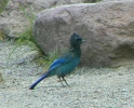
This Steller's Jay was quite the poser, and quite loud


09/07/2007

The weather turned rainy and cold on us and our primary hike had no open parking.

So moving on to plan B we decided to just go from one end of the Going-To-The-Sun-Highway to the other and hopefully get in some sights and maybe a little walk to a falls.

Funny how doing nothing seems to generate lots and lots of pictures.


PICTURES/Glacier When It Rains/t_Going-to-the-Sun-Road8.JPG
West to East on Going-To-The- Sun-Highway
PICTURES/Glacier When It Rains/t_West Tunnel3.JPG
Entering the West Tunnel
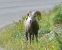
PICTURES/Glacier When It Rains/t_Mountain Sheep7.JPG
Great horned sheep
PICTURES/Glacier When It Rains/t_Mountain Sheep10.JPG
He just stood on the ridge looking at all us gawking tourists taking his picture
PICTURES/Glacier When It Rains/t_Glacier Valley1.JPG
Just a pretty valley shot, well considering the rain and overcast conditions
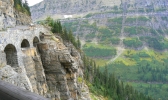
PICTURES/Glacier When It Rains/t_Tripple Arches Bridge2.JPG
The Tripple Arches are considered an engineering marvel (don't ask me why)
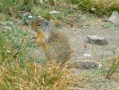
PICTURES/Glacier When It Rains/t_Ground Squirrel5.jpg
A little ground squirrel we saw at the Oberling Bend overlook
PICTURES/Glacier When It Rains/t_Red Bus Logan Lodge4.JPG
The old red busses were parked at Logan Lodge. They have been loving restored by Ford
PICTURES/Glacier When It Rains/t_Red Bus Logan Lodge5.JPG
No matter how nostalgic these are I'm not sure I want to tour the park in one with lots of others packed in like sardines
PICTURES/Glacier When It Rains/t_Glacier Valley5.JPG
This is a beautiful example of a glacier valley
PICTURES/Glacier When It Rains/t_Mountain Sheep6a.jpg
A great horned poser
PICTURES/Glacier When It Rains/t_East Tunnel1.JPG
The East Tunnel
PICTURES/Glacier When It Rains/t_Jackson Glacier1.JPG
What's left of Jackson Glacier.
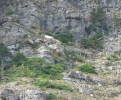
PICTURES/Glacier When It Rains/t_Mountain Goats17.JPG
Look really, really close and you'll see two white spots way up on that mountain
PICTURES/Glacier When It Rains/t_Mountain Goats10a.jpg
The white spots are mountain goats. We thought they were statues they were so still
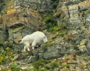
PICTURES/Glacier When It Rains/t_Mountain Goat1.jpg
They look so powerful
PICTURES/Glacier When It Rains/t_Mountain Goat5.JPG
Good shot of his face and horns
PICTURES/Glacier When It Rains/t_Sunrift Gorge Sign1.jpg
Sunrift Gorge
PICTURES/Glacier When It Rains/t_Sunrift Gorge2-Cannon.jpg
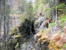
Little shot up the creek
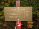
PICTURES/Glacier When It Rains/t_St Mary Falls Trail.jpg
The weather determined how far on the trail we could get
PICTURES/Glacier When It Rains/t_St Mary Falls5-Cannon.jpg
We made it to Baring Falls but then the pouring rain ended our little hike
PICTURES/Glacier When It Rains/t_Mountains In Mist5.JPG
We thought this was a beautiful shot until that cloud moved in and we were in a white out driving back across the mountains


09/08/2007

The Granite Park Chalet can be reached by several trails. From Logan Pass it's 14 miles round trip. From The Loop Trail it's 8 miles round trip. We opted for The Loop Trail since we wanted to do some other things that day and were not sure we could do the 14 miles and still have enough umph left.

Well you know what they say about best laid plans. Loop Trail may be only 4 miles but it's 4 miles of 2300 foot elevation gain. Then 4 miles down. The hike is worth it however despite the gasping lungs and stubbed toes. Once at the Chalet you are rewarded with beautiful vistas.


PICTURES/Glacier - The Loop Trail/t_Heavens Peak.JPG
Heaven's Peak from the start of Loop Trail
PICTURES/Glacier - The Loop Trail/t_Bridge.JPG
Pretty little bridge at the start of the trail
PICTURES/Glacier - The Loop Trail/t_Sharon Starting On Trail.JPG
At the start of the hike we were pretty cold
PICTURES/Glacier - The Loop Trail/t_View Along Trail.JPG
Yup, it's pretty up here
PICTURES/Glacier - The Loop Trail/t_Sharon Up The Trail.JPG
Going up and up and up and you'll notice clothing is being shed
PICTURES/Glacier - The Loop Trail/t_Granite Chalet1.JPG
First glimpse of The Granite Chalet
PICTURES/Glacier - The Loop Trail/t_Granite Chalet Sign.JPG
Dedication plaque
PICTURES/Glacier - The Loop Trail/t_Granite Chalet3.JPG
The main building
PICTURES/Glacier - The Loop Trail/t_Granite Chalet5.JPG
The other buildings in the complex
PICTURES/Glacier - The Loop Trail/t_View From Chalet1.JPG
A view from the Chalet
PICTURES/Glacier - The Loop Trail/t_View From Chalet2.JPG
Another view from the Chalet. I'd say it was worth the hike
PICTURES/Glacier - The Loop Trail/t_Us At Chalet.JPG
Everyone was taking pictures for everyone else
PICTURES/Glacier - The Loop Trail/t_Valley View From Trail1.JPG
View from the trail heading back down
PICTURES/Glacier - The Loop Trail/t_Sharon on trail2.jpg
Going down, and down, and down. Oh, my toes
PICTURES/Glacier - The Loop Trail/t_Mountain Goat5.JPG
Driving west after the hike we saw more of the mountain goats
PICTURES/Glacier - The Loop Trail/t_Mountain Goat11a.jpg
How they climb on those steep slopes is just amazing
PICTURES/Glacier - The Loop Trail/t_Goose Island9.JPG
That little piece of land is Goose Island
PICTURES/Glacier - The Loop Trail/t_Goose Island2.JPG
Not much of an island is it?


09/10/2007

We left Glacier and drove up into Alberta to Banff where we stayed the night before starting on the Icefields Parkway that runs through both Banff and Jasper parks.

Since we were going to stay in Hinton on the outskirts of Jasper we figured we would explore the southern portion today and the northern sections tomorrow.

After consulting our map we decided to do a little hike to Bow Glacier and then do some sightseeing while driving up to Jasper.


PICTURES/Banff National Park - Alberta Canada/t_Road Shots 2.JPG
A shot of The Icefields Parkway
PICTURES/Banff National Park - Alberta Canada/t_Crowfoot Glacier 5.JPG
This is Crowfoot Glacier. So named because it had 3 toes like a crow but one has melted away
PICTURES/Banff National Park - Alberta Canada/t_Mountain Sheep7.JPG
Big horned sheep - well these are females and young males
PICTURES/Banff National Park - Alberta Canada/t_Mountain Sheep3.JPG
Camera hog
PICTURES/Banff National Park - Alberta Canada/t_Bow Lake & Mountains9.JPG
You just can't believe the aqua color of the lakes here
PICTURES/Banff National Park - Alberta Canada/t_Bow Lake, Glacier & Mountains4.JPG
That's the Bow Glacier up there
PICTURES/Banff National Park - Alberta Canada/t_Sharon On Lake Shore2.JPG
The path starts out around the lake
PICTURES/Banff National Park - Alberta Canada/t_Bow Valley5.JPG
Eventually you get up on the ridge and look over to Bow Falls which was our destination
PICTURES/Banff National Park - Alberta Canada/t_Watterfall8.JPG
Bow Falls
PICTURES/Banff National Park - Alberta Canada/t_Valley Floor1.JPG
Heading back you get a great view of the valley floor you cross heading back to the parking area
PICTURES/Banff National Park - Alberta Canada/t_Num-ti-jah Lodge1.JPG
This is the Num-ti-jah Lodge and you get a beautiful view of it as you come back along the trail
PICTURES/Banff National Park - Alberta Canada/t_Columbia Icefield 2.JPG
Back on the road heading north and we see The Columbia Icefield
PICTURES/Banff National Park - Alberta Canada/t_Columbia Icefield 4.JPG
They have guided tours and track busses that take you out onto the glacier


09/11/2007

Today we headed south into Jasper National Park and did some nice touristing.

First stop was Maligne Canyon (pronounced mah-leen). This is a spectacular canyon with beautiful aqua water rushing down toward Maligne Lake. We turned back after crossing the 5th bridge but you can go several more miles.

The second stop was Athabasca Falls. It's a short walk with more magnificent falls and rushing water. Again that incredible aqua color.

Naturally we did a number of other stops along the Icefields Parkway but for the sake of brevity I will not post the dozens of shots of trees, paths, streams, rivers and mountains. However my restraint does not mean I won't include at least some of the shots of the great horned sheep that are everywhere in the park.


PICTURES/Jasper National Park - Alberta Canada/t_Start of Falls1.JPG
The beginning of the canyon walk
PICTURES/Jasper National Park - Alberta Canada/t_Canyon & Bridge2B.JPG
Bridge 2 across the Maligne River
PICTURES/Jasper National Park - Alberta Canada/t_Canyon Shot12.JPG
Just one of the many canyon shots
PICTURES/Jasper National Park - Alberta Canada/t_River.JPG
Lots of beautiful views of the river and surrounding mountains
PICTURES/Jasper National Park - Alberta Canada/t_Athabasca Falls6.JPG
Athabasca Falls
PICTURES/Jasper National Park - Alberta Canada/t_Shot Down Canyon7.JPG
Athabasca River is just as blue as Maligne or Bow Lake
PICTURES/Jasper National Park - Alberta Canada/t_Stairs2.JPG
These stairs were so pretty placed in between rock formations
PICTURES/Jasper National Park - Alberta Canada/t_Athabasca River1.JPG
Lovely Athabasca River
PICTURES/Jasper National Park - Alberta Canada/t_Mountain Sheep1.JPG
As promised more sheep
PICTURES/Jasper National Park - Alberta Canada/t_Mountain Sheep5.JPG
The expression on his face is so serene
PICTURES/Jasper National Park - Alberta Canada/t_Mountain Sheep15.JPG
No matter how many we saw we were still impressed
PICTURES/Jasper National Park - Alberta Canada/t_Mountain Sheep13.JPG
I think they just like to stop traffic because there's nothing in the road


09/12/2007

Our destination was Elk Island which is about an hour outside Edmonton.

It's a wildlife refuge that boasts of wood bison, plains bison (I didn't know there were different kinds), elk, lynx, moose and other wildlife.

All we saw were buffalo and a bird I can not identify.

Since it was 45 degrees with rain and a wind chill of 30 if we didn't see it from the truck it just wasn't seen.


PICTURES/Elk Island - Alberta Canada/t_Buffalo6.JPG
I have no idea if this is a plains or wood bison
PICTURES/Elk Island - Alberta Canada/t_Buffalo12.JPG
A little grooming
PICTURES/Elk Island - Alberta Canada/t_Buffalo15.JPG
I think this looks like a young cow myself
PICTURES/Elk Island - Alberta Canada/t_Buffalo17.JPG
If you look closely you can see other buffalo hiding in the tall grass out of the wind
PICTURES/Elk Island - Alberta Canada/t_Buffalo19.JPG
They just kind of walk in front of cars who naturally stop and gawk, like we did
PICTURES/Elk Island - Alberta Canada/t_Bird2a.jpg
Until now the only black and white bird I've seen is a penguin
PICTURES/Elk Island - Alberta Canada/t_Bird4a.jpg
He is rather unique looking


09/13/2007

Drumheller is south of Edmonton and claims to be the Dinosaur Capital of the World. It is home to the worlds largest dinosaur, The Royal Tyrrell Museum, Atlas Coal Mine, Willow Creek HooDoos, Badlands and The Little Church. In short, a tourists dream.

Although we took no pictures inside the museum it has the best palaeontology displays we have ever seen. Some of the displays were very unique and we saw more types of dinosaurs here than any place else.


PICTURES/Drumheller - A Tourists Dream/t_Drumheller Sign.JPG
Drumheller welcome sign
PICTURES/Drumheller - A Tourists Dream/t_Largest Diansaur1.JPG
The world's largest dinosaur. I'm standing at the base to give some idea of size
PICTURES/Drumheller - A Tourists Dream/t_Horsethief Canyon Sign.JPG
Every badlands has a horsethief canyon or basin
PICTURES/Drumheller - A Tourists Dream/t_Badlands1.JPG
Canada's badlands
PICTURES/Drumheller - A Tourists Dream/t_Use At Own Risk Sign.JPG
We liked the "Use At Own Risk" sign on the edge of the badlands
PICTURES/Drumheller - A Tourists Dream/t_Royal Tyrrell Museum Sign3.JPG
Yup, we were there
PICTURES/Drumheller - A Tourists Dream/t_Little Church Sign.JPG
You have to read this to appreciate the humor
PICTURES/Drumheller - A Tourists Dream/t_Little Church1.JPG
When they say little they mean it
PICTURES/Drumheller - A Tourists Dream/t_Little Church Inside1.JPG
Inside the Little Church
PICTURES/Drumheller - A Tourists Dream/t_Hoodoos Sign.JPG
HooDoos - who'd have thunk?
PICTURES/Drumheller - A Tourists Dream/t_Hoodoos7.JPG
HooDoos and HooDoo to be


09/13/2007

This is now a National Historic Site but until 1979 when the last Atlas Mine closed the area was a boom for coal miners.

The tippler building has been restored and the tour takes you up into the building where the coal was received and sorted.

Construction is still on-going but much is open to view including the washroom used by the miners after their shifts, the office, and a miner's home. Future plans include tours inside the mine by 2010.


PICTURES/Atlas Coal Mine - Drumheller/t_Tippler Processing Plant Sign.JPG
I have no idea why it's called a Tipple
PICTURES/Atlas Coal Mine - Drumheller/t_Tippler Building7.JPG
That's the tipple and some outlying buildings
PICTURES/Atlas Coal Mine - Drumheller/t_Tippler Building10.JPG
That long shaft is what we walked up
PICTURES/Atlas Coal Mine - Drumheller/t_Tippler Shaft To Mine1.JPG
This shaft goes to the mine and the coal is conveyed down to the tipple
PICTURES/Atlas Coal Mine - Drumheller/t_Inside Tippler1.JPG
Gears and the belt that brought the coal down
PICTURES/Atlas Coal Mine - Drumheller/t_Inside Tippler16.JPG
Going back down beside the belt
PICTURES/Atlas Coal Mine - Drumheller/t_Wash House1.JPG
The Wash House
PICTURES/Atlas Coal Mine - Drumheller/t_Wash House4.JPG
Each morning they took raised their clean clothes up on hooks and put them on after washing at the end of their shift
PICTURES/Atlas Coal Mine - Drumheller/t_Miners House2.JPG
One of the miner's houses
PICTURES/Atlas Coal Mine - Drumheller/t_Bunnies1.JPG
The decendants of bunnies kept by miners still live at the site - well fed I might add


09/15/2007

I love Devils Tower so since we are heading south anyway we decided to make another visit. This time the sun was shining and the tower looks completely different than on our last visit. It was also hosting a good number of rock climbers.

The area is so peaceful and varied. There is this great rock rising from the plains, surrounded by a small pine forest which makes for pleasant walking, and then the prairie dog town on the road in always give you a smile. Don't worry, I've narrowed down the 300 prairie dog shots to just a few for your viewing pleasure.


PICTURES/Devils Tower - Wyoming/t_Approaching Tower6.JPG
This always impresses me.
PICTURES/Devils Tower - Wyoming/t_Climbers2.JPG
Lots of climbers today
PICTURES/Devils Tower - Wyoming/t_Climbers4.JPG
That little spot of green is a climber. Give you some idea of scale doesn't it?
PICTURES/Devils Tower - Wyoming/t_Climbers5.JPG
She's prepared that's for sure. Lots of carabiners and hopefully PMI rope
PICTURES/Devils Tower - Wyoming/t_Climbers6.JPG
Two more climbers in between those columns
PICTURES/Devils Tower - Wyoming/t_Tower3.JPG
Vultures riding the air currents or waiting for an accident
PICTURES/Devils Tower - Wyoming/t_Tower25.JPG
The columns are more amazing as the light changes
PICTURES/Devils Tower - Wyoming/t_Tower & Birds1.JPG
More vultures
PICTURES/Devils Tower - Wyoming/t_Turkeys2.JPG
Lots of wild turkeys around the park
PICTURES/Devils Tower - Wyoming/t_Blue Bird14.JPG
My bluebird
PICTURES/Devils Tower - Wyoming/t_Facing PDs2.JPG
They were barking and chirping together
PICTURES/Devils Tower - Wyoming/t_Mom & Kids1.JPG
This mom and kids were so cute
PICTURES/Devils Tower - Wyoming/t_PD6.JPG
He's on lookout
PICTURES/Devils Tower - Wyoming/t_PD Head.jpg
Peek-a-boo
PICTURES/Devils Tower - Wyoming/t_PDs Playing.JPG
Playing around
PICTURES/Devils Tower - Wyoming/t_PD Poser3.JPG
This was our poser. He stood there for over 5 minutes


09/16/2007

The last time we came through South Dakota we did Wind Cave, so this time we decided to visit Jewel Cave, the second largest cave in the world but with new areas being discovered all the time it might just break into first. The calcite crystals that form so much of it make for very colorful pictures.

After our cave tour we drove through Custer State Park. This is a beautiful area which we want to explore further on another trip, but we did get some nice shots of pronghorns and turkeys. No buffalo this time.
PICTURES/Jewel Cave & Custer State Park, SD/t_P1040754.JPG
This did not look green in the cave. It's the reflections of the crystals and the flash
PICTURES/Jewel Cave & Custer State Park, SD/t_P1040761.JPG
So much texture in this cave
PICTURES/Jewel Cave & Custer State Park, SD/t_P1040763.JPG
More colors but these are much softer
PICTURES/Jewel Cave & Custer State Park, SD/t_P1040775.JPG
There were many of these in different shades
PICTURES/Jewel Cave & Custer State Park, SD/t_P1040776.JPG
See? More greys in this group - or else the reflection is different
PICTURES/Jewel Cave & Custer State Park, SD/t_P1040839.JPG
The fluorescent green was must so surprising
PICTURES/Jewel Cave & Custer State Park, SD/t_P1040842.JPG
Again the crystals and subtle colors
PICTURES/Jewel Cave & Custer State Park, SD/t_Pronghorns5.JPG
Custer State Park was teeming with pronghorns this time
PICTURES/Jewel Cave & Custer State Park, SD/t_Pronghorns6.JPG
These two kept running around the field
PICTURES/Jewel Cave & Custer State Park, SD/t_Pronghorns11.JPG
Another group lying about in the shade
PICTURES/Jewel Cave & Custer State Park, SD/t_Pronghorns12.JPG
I thought this shot was silly so I'm sharing it.
PICTURES/Jewel Cave & Custer State Park, SD/t_Turkeys4.JPG
Turkeys everywhere. Ben Franklin would be happy
PICTURES/Jewel Cave & Custer State Park, SD/t_Turkeys8.JPG
I like the way the sun shines through their waddles (is that the right term?)