GoFools


Glacier Trip 2012

08/22/2012 to 08/28/2012

This was our second trip to Glacier since once is not enough. We stayed at the old Many Glaciers Hotel which is central to most of the hikes in the area.

This place is just amazing and the diversity of wildlife is one of the big attractions. Naturally we were hoping to see some bears - from a great distance and not up close - as well as sheep, goats and more. We were not disappointed.


Many Glaciers Hotel 08/22/2012 to 08/25/2012

The Many Glacier Hotel was built in 1915 by the Great Northern Railroad as a draw for visitors. The theme is a Swiss Chalet on steroids. The building is huge, the rooms small, but the view is magnificant. Sitting on Swiftcurrent Lake you are surrounded by huge peaks, lush trees and lots of critters.


PICTURES/Many Glaciers Hotel/t_MGH5.JPG
They certainly knew about location when they built this place
PICTURES/Many Glaciers Hotel/t_MGH2.JPG
Our Swiss Chalet
PICTURES/Many Glaciers Hotel/t_MGH3.JPG
Viewing the hotel from across Swiftcurrent Lake
PICTURES/Many Glaciers Hotel/t_MGH8.JPG
Looking at the front of the hotel
PICTURES/Many Glaciers Hotel/t_Mt Wilbur & MGH.JPG
Oh ya! Is that a setting or is that a setting?
PICTURES/Many Glaciers Hotel/t_Glac_many_glacier_hotel_071506e.jpg
Inside you can see the abundant use of wood. And yes, it is noisy
PICTURES/Many Glaciers Hotel/t_MGH Porch.JPG
Sitting on the back porch after dinner. And just what am I looking at?
PICTURES/Many Glaciers Hotel/t_View From MGH3.JPG
This is what I'm looking at. Pretty impressive I think
PICTURES/Many Glaciers Hotel/t_View From MGH7.JPG
Mt. Wilbur. OK, no idea who Wilbur was
PICTURES/Many Glaciers Hotel/t_View From MGH10.JPG
Worth the price of admission - or in other words BEAUTIFUL


Grinnell Glacier Trail 08/23/2012

There are 2 Grinnell hikes. One goes right to Grinnell Lake. The other goes up to Grinnel Glacier. We chose the latter.

We decided to take the morning boat across Swiftcurrent Lake and then go over the short trail to Lake Josephine and take the second boat to the trailhead. Just something different.

This was an incredible hike. Tremendous scenery, lots of elevation gain, and a glacier at the end. What more could you possibly ask for? Well, maybe an espresso stand but what the heck. A little suffering is good for the soul.


PICTURES/Grinnell Glacier Trail/t_MGH Dock.JPG
The dock outside the hotel and the boat that will take us across the lake
PICTURES/Grinnell Glacier Trail/t_Grennell Glacier Sign.JPG
I like the quotes - good sense of humor. Funny how only white folks can discover something that has been around for thousands of years
PICTURES/Grinnell Glacier Trail/t_First Leg of GGT.JPG
Starting up the trail - lots of folks came off the boat with us
PICTURES/Grinnell Glacier Trail/t_Jenny Lake1a.JPG
Looking back down at Lake Josephine
PICTURES/Grinnell Glacier Trail/t_Grennell Glacier Trail2.JPG
Our destination is that mountain
PICTURES/Grinnell Glacier Trail/t_Grennell Glacier Trail10.JPG
Getting a little elevation
PICTURES/Grinnell Glacier Trail/t_Grennell Glacier Trail5.JPG
That is Grennell Lake
PICTURES/Grinnell Glacier Trail/t_Grennell Glacier Trail20.JPG
I am here for scale so you can get some idea of the nice slide down if you fall
PICTURES/Grinnell Glacier Trail/t_Grennell Glacier View2.JPG
A glimpse of Grinnell Glacier
PICTURES/Grinnell Glacier Trail/t_Grennell Glacier Trail26.JPG
The road goes ever on an on
PICTURES/Grinnell Glacier Trail/t_Yes, there is a big drop here.JPG
Pointing out the big drop from here
PICTURES/Grinnell Glacier Trail/t_Grennell Glacier Lake19.JPG
Another view of Grennell Lake - every turn has something incredible
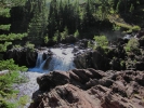
PICTURES/Grinnell Glacier Trail/t_Grennell Glacier Trail Waterfalls20.JPG
There is this nice little waterfall along the trail. The rockss are slick
PICTURES/Grinnell Glacier Trail/t_Grennell Glacier Trail Waterfalls16.JPG
You also do get wet as you go past the falls
PICTURES/Grinnell Glacier Trail/t_Grennell Glacier Lake15.JPG
Looking back across Grinnell Lake, Lake Josephine, and Swiftcurrent Lake
PICTURES/Grinnell Glacier Trail/t_Grennell Glacier Falls19.JPG
A good glimpse of the falls at Grinnell Glacier
PICTURES/Grinnell Glacier Trail/t_Grennell Glacier23.JPG
Grinnell Glacier - what is left of it anyway
PICTURES/Grinnell Glacier Trail/t_Grennell Glacier9.JPG
This is what we came to see
PICTURES/Grinnell Glacier Trail/t_Jenny Lake3.JPG
Coming back to Lake Josephine - the boat is leaving us behind
PICTURES/Grinnell Glacier Trail/t_Jenny Lake Dock2.JPG
Well we will just wait for the next boat or walk back along the lake
PICTURES/Grinnell Glacier Trail/t_Jenny Lake12.JPG
I think walking back would not be such a bad idea


Going-To-The-Sun Road 08/24/2012

The beautiful weather we had yesterday went elsewhere. Today it was a less than balmy 44 with wind and rain. Not great hiking weather for us, so we drove Going-To-The-Sun Road. This is one of those great engineering marvels from the 1930s and is the only road through the park. There is some work being done on it which it needs after 75 years of tourists, and it can bet a bit tight in spots, but the views are so worth it. No matter what the weather, this is a must do if you go to Glacier.


PICTURES/Going-To-The-Sun Road/t_Going to the Sun Highway2.JPG
Just a stretch of the road
PICTURES/Going-To-The-Sun Road/t_Mist on Mountains2.JPG
Lots of mist on the mountains
PICTURES/Going-To-The-Sun Road/t_Going to the Sun Highway3.JPG
Do not even think about moving at speed on this road.
PICTURES/Going-To-The-Sun Road/t_Logans Pass2.jpg
Up on Logans Pass, the high point. The wind was firece and the mist shrouded everything
PICTURES/Going-To-The-Sun Road/t_Scene From Highway1.JPG
Heading down the other side of the mountain the weather was a bit clearer
PICTURES/Going-To-The-Sun Road/t_Mountain Goats1.JPG
Mountain goats. This is the same spot we saw them in on our last trip
PICTURES/Going-To-The-Sun Road/t_Scene From Highway3.JPG
Thankfully the traffic is slow and there are enough pull-outs from which to appreciate the amazing views


Swiftcurrent Pass Trail 08/25/2012

We decided on this hike because it was so very different from the Grinnell Glacer trail. It has 3 possible parts. Red Rock Falls, Bullhead Lake, and the Swiftcurrent Headwall and Pass.

The pass would take us over to the Granit Park Chalet, which we hiked to on our last trip, so we decided to go just to the Headwall and then come back.

This trail has some open areas but a great deal of it is a small cut through shrubs and trees. We did our usual bear calls - my favorite is YoYo Ma since I figure all bears are cello fans - so although we saw bear scat, we met no bears.


PICTURES/Swiftcurrent Pass Trail/t_Directional Tree.jpg
This reminded us of the Cherokee Directional Trees we saw in South Carolina
PICTURES/Swiftcurrent Pass Trail/t_Red Rock Lake4.JPG
Red Rock Lake - the first stop on the trail
PICTURES/Swiftcurrent Pass Trail/t_Red Rock Lake7.JPG
Supposedly this is a great area for moose, but not when we were there
PICTURES/Swiftcurrent Pass Trail/t_Red Rock Falls1.jpg
Red Rock Falls
PICTURES/Swiftcurrent Pass Trail/t_Red Rock Falls70.JPG
Shooting from up on top of the craggy cliff
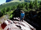
PICTURES/Swiftcurrent Pass Trail/t_George Over Red Rock Falls3.jpg
Yes George loves to stand on the edge of those craggy cliffs
PICTURES/Swiftcurrent Pass Trail/t_Red Rock Falls73.JPG
The falls flowing out into Red Rock Lake
PICTURES/Swiftcurrent Pass Trail/t_Swiftcurrent Trail2.jpg
See what I mean by narrow trail
PICTURES/Swiftcurrent Pass Trail/t_Swiftcurrent Trail3.JPG
Great views however. Yes, that is where we are going
PICTURES/Swiftcurrent Pass Trail/t_Deer1.JPG
We spotted this deer on one of the sections through the woods
PICTURES/Swiftcurrent Pass Trail/t_Deer2.JPG
She was a bit shy but she did let us take her picture
PICTURES/Swiftcurrent Pass Trail/t_Swiftcurrent Trail6.JPG
The vegetation was very lush, even for this late in the summer
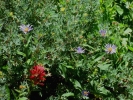
PICTURES/Swiftcurrent Pass Trail/t_Flowers3.jpg
The flowers were really pretty. Too bad my pictures do not do them justice
PICTURES/Swiftcurrent Pass Trail/t_Flowers5.JPG
More pretty flowers, and tons of berries everywhere
PICTURES/Swiftcurrent Pass Trail/t_Bullhead Lake6.JPG
Approaching Bullhead Lake
PICTURES/Swiftcurrent Pass Trail/t_Bullhead Lake1.JPG
This is Bullhead Lake, the third lake on the hike
PICTURES/Swiftcurrent Pass Trail/t_Bullhead Lake5.JPG
Bullhead Lake would have been better with a moose or two
PICTURES/Swiftcurrent Pass Trail/t_Swinging Bridge1.JPG
This was a great little swinging bridge you crossed before getting to the Headwall
PICTURES/Swiftcurrent Pass Trail/t_Swiftcurrent Headwall11.JPG
The Headwall. There was a great snow formation at the bottom of the falls
PICTURES/Swiftcurrent Pass Trail/t_Swiftcurrent Headwall3.jpg
The path on the far right goes up and over the mountain and then onto Granit Park Chalet


Glacier Critters 08/26/2012

Except for a moose, we feel we saw a nice amount of critters on the trip. Some we just happend upon while hiking. Others were seen along the side of the road. In the case of the mountain goats they were not far from the hotel, but very high up on the cliff face. The bears were alll feeding along the road - well away from us I will add - so neither they nor we were in any danger.

Since I am on overload with the vast amount of trail shots, I figured I would just lump all the critters into their own place.


PICTURES/Glacier Critters/t_Grizz14.JPG
Hey, what is that eating those huckleberries
PICTURES/Glacier Critters/t_Grizz24.JPG
Are those ears?
PICTURES/Glacier Critters/t_Grizz18.JPG
Wow, a bear
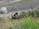
PICTURES/Glacier Critters/t_Grizz64.JPG
A grizzly bear eating huckleberries
PICTURES/Glacier Critters/t_Grizz6.jpg
A really big grizzly bear eating huckleberries
PICTURES/Glacier Critters/t_Dark Grizz11.JPG
Next day we saw a bunch of people staring up the slope not far from our hotel, so naturally we stared too.
PICTURES/Glacier Critters/t_Dark Grizz18.JPG
Whatever it is, it keeps moving into the bushes
PICTURES/Glacier Critters/t_Dark Grizz16.JPG
OK, another grizzly bear
PICTURES/Glacier Critters/t_Dark Grizz23.JPG
I subsequently learned from a ranger they have 2 collard females in the park. This one looks pregnant to me
PICTURES/Glacier Critters/t_Black Bear2.JPG
After dinner we drove around and saw this little guy feasting up on the ridge. Our only black bear
PICTURES/Glacier Critters/t_Mountain Goats by MGH1.JPG
Same day as the black bear, we saw the mountain goats on the cliff.
PICTURES/Glacier Critters/t_Mountain Goats by MGH3.JPG
We need a bigger lens
PICTURES/Glacier Critters/t_Columbian Ground Squirrel1.JPG
Small critters were all over the Grinnell Glacier Trail. This little fellow is a Columbian Ground Squirrel
PICTURES/Glacier Critters/t_Marmot On Rock2.JPG
Marmot - big Hoary marmot - on a rock
PICTURES/Glacier Critters/t_Marmot On Rock5.JPG
We were not sure if it was really alive, but it looked really cute anyway
PICTURES/Glacier Critters/t_Marmot1.JPG
Higher up on the Grinnell Glacier Trail we came on more Hoary marmots.
PICTURES/Glacier Critters/t_Marmot3.JPG
Cute little guy. Love the face
PICTURES/Glacier Critters/t_Marmot6.JPG
On the run - looking for tourists to impress
PICTURES/Glacier Critters/t_Marmot11.JPG
These guys were right up by the glacier. A couple were the size of small dogs
PICTURES/Glacier Critters/t_Marmot16.JPG
Some woman kept saying it was a wolverine. Get real. Would I be this close to a wolverine?
PICTURES/Glacier Critters/t_wolverine.jpg
Just for reference, this is what a wolverine looks like. Not even close.
PICTURES/Glacier Critters/t_Marmot9.JPG
Really cute for a big rat
PICTURES/Glacier Critters/t_Mountain Sheep1.JPG
These mountain sheep just wandered by our hotel window.
PICTURES/Glacier Critters/t_Mountain Sheep3.JPG
Shooting through the screen was a bit tough, but since they were moving fast we took what we could get
PICTURES/Glacier Critters/t_P1140298.JPG
On our way out of Glacier we passed by the Osprey nest box. They were busy eating on something.


Idaho Labs Experimental Breeder Reactor1 08/27/2012

On our trip through Idaho last year we stopped in Arco, the first town to be lit by nuclear power. Unfortunately the EBR (experimental breeder reactor) site was closed for the season, but this time we were in luck.

The INL is a huge complex that covers 890 acres and has multiple active sites. It is also where the nuclear powered submarine was developed. Yes, Idaho. Anyway, this is a great tour to take. It has always been a non-weapons facility, something they stress, and it has been a part of many nuclear related tests and research, including the recent Fukushima Facility disaster.

Nuclear supporter or not, this is a part of our history and worth the quick side-trip.
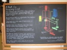


PICTURES/Idaho Labs Experimental Breeder Reactor1/t_P1140342.JPG
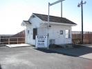
The EBR Building - not what I was expecting
PICTURES/Idaho Labs Experimental Breeder Reactor1/t_IMG_2414.jpg
Quaint guard shack
PICTURES/Idaho Labs Experimental Breeder Reactor1/t_IMG_2418.jpg
These well worded and easy to read signs were placed in various spots to help us dummies understand the complex
PICTURES/Idaho Labs Experimental Breeder Reactor1/t_P1140318.JPG
Leggo land was where the washed rods were put in individually numbered holes
PICTURES/Idaho Labs Experimental Breeder Reactor1/t_IMG_2432.jpg
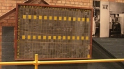
Simple means of tracking the washed rods pulled; a blackboard
PICTURES/Idaho Labs Experimental Breeder Reactor1/t_IMG_2433.jpg
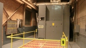
Facility for washing the rods
PICTURES/Idaho Labs Experimental Breeder Reactor1/t_IMG_2423.jpg
Oh, I have no ideas what this was, but there was a lot of big machines everywhere
PICTURES/Idaho Labs Experimental Breeder Reactor1/t_IMG_2429.jpg
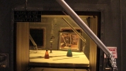
Looking into the Hot Cell room where radio active materials could be inspected and repaired
PICTURES/Idaho Labs Experimental Breeder Reactor1/t_IMG_2430.jpg
The manipulator arms for the hot cell
PICTURES/Idaho Labs Experimental Breeder Reactor1/t_P1140332.JPG
There are 32 layers of oil-separated glass to protect the worker
PICTURES/Idaho Labs Experimental Breeder Reactor1/t_P1140333.JPG
Note the picture in the lower right taken of an employee using the arms
PICTURES/Idaho Labs Experimental Breeder Reactor1/t_P1140319.JPG
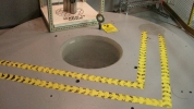
This is the top of the reactor core
PICTURES/Idaho Labs Experimental Breeder Reactor1/t_IMG_2441.jpg
The top of the reactor core - viewed through plexiglass now
PICTURES/Idaho Labs Experimental Breeder Reactor1/t_IMG_2439.jpg
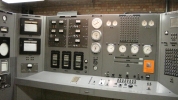
The control room panel
PICTURES/Idaho Labs Experimental Breeder Reactor1/t_P1140320.JPG
Control Room
PICTURES/Idaho Labs Experimental Breeder Reactor1/t_IMG_2446.jpg
Lead windows looking into the reflector repair room
PICTURES/Idaho Labs Experimental Breeder Reactor1/t_IMG_2447.jpg
Down in the core area
PICTURES/Idaho Labs Experimental Breeder Reactor1/t_P1140329.JPG
Zero Power Reactor - I can only think of ZPM from StarGate SG1
PICTURES/Idaho Labs Experimental Breeder Reactor1/t_P1140322.JPG
All the men at the project signed the wall and noted the date the first peaceful atomic power was used to generate electricity. No women were allowed to sign
PICTURES/Idaho Labs Experimental Breeder Reactor1/t_P1140336.JPG
The two X-39 Atomic Engines - The US thought the Russians had nuclear powered planes so we had to have them as well
PICTURES/Idaho Labs Experimental Breeder Reactor1/t_P1140338.JPG
Needless to say these never flew. You would need a 10 mile long runway to begin. And these do not even have the shielding on them to protect pilots
PICTURES/Idaho Labs Experimental Breeder Reactor1/t_P1140340.JPG
I am in this for scale. Imagine the size of the plane you would need. Happily ICBMs became possible and this was scrapped. Did I just put Happy and ICBM in the same quote?


Old Iron Town Ruins - Cedar City UT 08/28/2012

If you know us, you know we just can not pass up an old mine, ruin, kiln, whatever. This is one of those places we read about years ago but had not gotten to until this trip.

In 1868 Ebenezer Hanks organized the Union Iron Company. At its height the town had almost 100 people, a schoolhouse, foundry, machine shop and more. In 1877 the Union Iron Company closed its doors and the town died.


PICTURES/Old Iron Town Ruins - Cedar City UT/t_Old Irontown Plaque.JPG
In 1939 this plaque was put up to commemorate Irontown
PICTURES/Old Iron Town Ruins - Cedar City UT/t_Kiln2.jpg
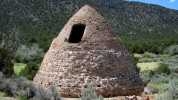
The one remaining charcoal kiln
PICTURES/Old Iron Town Ruins - Cedar City UT/t_Kiln6.JPG
There is a nice trail around the site that gives some views of the area
PICTURES/Old Iron Town Ruins - Cedar City UT/t_Kiln9.JPG
There were 2 kilns at one time but the other came to ruin thanks to vandals and erosion
PICTURES/Old Iron Town Ruins - Cedar City UT/t_Furance Ruins2.JPG
The ramining chimney from the foundry
PICTURES/Old Iron Town Ruins - Cedar City UT/t_Arrastra1.JPG
This is an arrastra used to grind the molding sand
PICTURES/Old Iron Town Ruins - Cedar City UT/t_Foundry Ruins7.JPG
Not too much is left of the foundry buildings
PICTURES/Old Iron Town Ruins - Cedar City UT/t_Salamanders Sign1.JPG
I never heard this term before in regard to rocks
PICTURES/Old Iron Town Ruins - Cedar City UT/t_Slaamanders1.JPG
This is a salamander
PICTURES/Old Iron Town Ruins - Cedar City UT/t_House4.JPG
This old house, or what is left of it, is on the little walking path
PICTURES/Old Iron Town Ruins - Cedar City UT/t_House5.JPG
The walls are substantial


Cedar Breaks National Monument - Utah 08/28/2012

When we left Cedar City we took UT-14, the scenic route. Since this road goes right past the southern entrance to Cedar Breaks we decided to do a side trip since we love to see all the parks we can. We are so glad we took the time.

The geology is much like that of Bryce but with more trees and nice, cool temperatures. Since it was getting late in the day we did not have time to do any of the hikes so we settled for driving the scenic road and taking in the overlooks. Wish all the things we had to settle for in life were this good. Must go back.
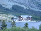
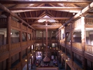

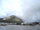
PICTURES/Cedar Breaks National Monument - Utah/t_Cedar Breaks National Monument.jpg
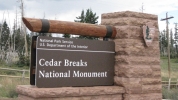
Cedar Breaks National Monument
PICTURES/Cedar Breaks National Monument - Utah/t_Cedar Breaks Ranger Station.jpg
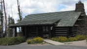
I liked the ranger station. Small, but comfy
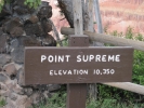
PICTURES/Cedar Breaks National Monument - Utah/t_Point Supreme Sign.jpg
Point Supreme - first overlook on our scenic drive. Note the elevation
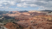
PICTURES/Cedar Breaks National Monument - Utah/t_Point Supreme2.jpg
Lots of great colors
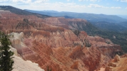
PICTURES/Cedar Breaks National Monument - Utah/t_Point Supreme12.JPG
Looks a lot like Bryce I think
PICTURES/Cedar Breaks National Monument - Utah/t_Sunset View Sign2.JPG
Sunset View Overlook
PICTURES/Cedar Breaks National Monument - Utah/t_Sunset View4.JPG
Love the drastic color variations
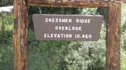
PICTURES/Cedar Breaks National Monument - Utah/t_Chessman Ridge Sign.jpg
Chessmen Ridge Overlook Getting higher
PICTURES/Cedar Breaks National Monument - Utah/t_Chessman Ridge5.JPG
I probably would not call these chessmen
PICTURES/Cedar Breaks National Monument - Utah/t_Chessman Ridge6.JPG
Always a balancing rock somewhere out here in the west
PICTURES/Cedar Breaks National Monument - Utah/t_Chessman Ridge8.JPG
Me, at the overlook
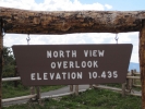
PICTURES/Cedar Breaks National Monument - Utah/t_North View Overlook Sign.jpg
North View Overlook - at this elevation it is quite cool even in August
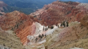
PICTURES/Cedar Breaks National Monument - Utah/t_North View Overlook2.jpg
Just some more magnificent views
PICTURES/Cedar Breaks National Monument - Utah/t_North View Overlook5.JPG
It almost looks like snow
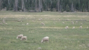
PICTURES/Cedar Breaks National Monument - Utah/t_Sheep1.jpg
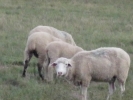
As we drove on to I-15 on UT-14 we saw this flock of sheep
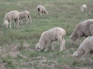
PICTURES/Cedar Breaks National Monument - Utah/t_Sheep5.JPG
We had a good time watching them graze. I am sure the rancher who was there thought we were crazy
PICTURES/Cedar Breaks National Monument - Utah/t_Sheep3.jpg
This is the only one who quit eating long enough to look up for a picture