GoFools


Minnesota Trip 2013 WIth A Couple Sidetrips

08/01/2013 to 08/17/2013

We wanted to see the kids and grandkids and escape the heat, so a trip up north in August seemed a good idea. The kids are out of school, and it is hot as blazes here in the Valley.

We did a couple stops along the way just to keep up our record of never missing the best schlock America has to offer, but the majority of our fun was had in Minnesota with friends and family - and those pics will be in the By Invitation Only to spare the general viewing audience from cutsie shots of kiddies.

From Grand Marais on Lake Superior, up the countrys highest paved road, and of course a visit to an old fort, we thoroughly enjoyed our trip.


The Big Well - Greensburg KS 08/01/2013

Greensburg is known for only 2 things. The Big Well - the largest hand dug well in the country - and for being blown off the map by a killer tornado in 2007.

We stopped by in 2009 and tried to see the well, but it was not open to the public. We did take a couple of shots, and we have stopped by every couple of years since then in hopes we could take The Well Tour.

This year, to our surprise, it is open. Not only open, but now contained in a huge, state of the art building highlighting the history of The Well and the town


PICTURES/The Big Well - Greensburg KS/t_Greensburg Big Well1.JPG
The Big Well back in 2009
PICTURES/The Big Well - Greensburg KS/t_Old well picture.JPG
Peering through the glass you could glimpse down into the well
PICTURES/The Big Well - Greensburg KS/t_IMG_3545.jpg
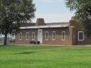
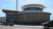
TADA - the new facility. It even says The Big Well. Imagine our surprise
PICTURES/The Big Well - Greensburg KS/t_IMG_3524.jpg
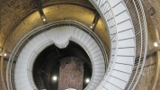
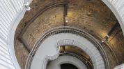
Looking down the spiraling staircase to the coins folks toss down the well.
PICTURES/The Big Well - Greensburg KS/t_IMG_3529.jpg
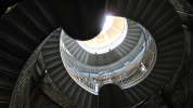
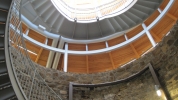
Looking up from about the middle of the well. The walls are quite impressive
PICTURES/The Big Well - Greensburg KS/t_IMG_3531.jpg
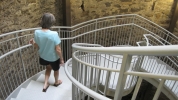
Further down the stairs.
PICTURES/The Big Well - Greensburg KS/t_IMG_3539.jpg
OK, an artsy shot. Had to add it.
PICTURES/The Big Well - Greensburg KS/t_IMG_3543.jpg
Kind of give you a good idea of what the well walls look like
PICTURES/The Big Well - Greensburg KS/t_IMG_3526.jpg
Lots of stairs
PICTURES/The Big Well - Greensburg KS/t_IMG_3527.jpg
We liked the way they used wood with the rock. Very nicely done
PICTURES/The Big Well - Greensburg KS/t_IMG_3540.jpg
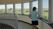
At the top you have a 360 panorama of the town complete with decals on the window explaining what you are looking at
PICTURES/The Big Well - Greensburg KS/t_IMG_3542.jpg
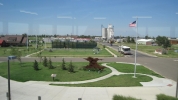
Just one of the scenes from the observatory


Grand Marais Minnesota 08/07/2013 to 08/09/2013

Grand Marais was always a favorite of ours when we lived in Minnesota and we were happy to go back there again.

The rocks, scenery, people and the beauty of Lake Superior make it worth the drive.

We were also more than pleased to revisit our favorite places, like The Angry Trout Restaurant.

It warms your heart to know some things are just where you left them 15 years ago.


PICTURES/Grand Marais/t_Our Condo.jpg
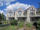
Our Condo
PICTURES/Grand Marais/t_View From Master Bedroom2.JPG
View from the master bedroom
PICTURES/Grand Marais/t_Harbor1.JPG
Evening shot of the bay outside our back door
PICTURES/Grand Marais/t_Beach.jpg
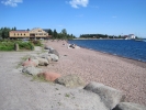
Looking up the beach toward our condo. That little store has a great coffee bar
PICTURES/Grand Marais/t_Harbor9.JPG
Morning shot of the bay outside our back door
PICTURES/Grand Marais/t_Cairns4.JPG
Folks like to create artistic and interesting cairns along the rocks
PICTURES/Grand Marais/t_Cairns2.JPG
More creative cairns
PICTURES/Grand Marais/t_Seagull2.JPG
Seagulls are everywhere. For the first couple of hours you love hearing them. Then you wish they would shut up. At 4 am you just want them dead
PICTURES/Grand Marais/t_View of point1.JPG
One of the points on the lake
PICTURES/Grand Marais/t_Quinn & Kayaks.JPG
Lone sole on the rocks watching the kayakers go by
PICTURES/Grand Marais/t_Artists Point Sign.JPG
Info about Artists Point
PICTURES/Grand Marais/t_Artists Point3.JPG
Artists Point - the most painted part of Grand Marais
PICTURES/Grand Marais/t_Sea Wall1.JPG
The sea wall going out to the lighthouse
PICTURES/Grand Marais/t_Lighthouse Point1.JPG
Looking out at the lighthouse
PICTURES/Grand Marais/t_Lighthouse Point2.JPG
The lighthouse
PICTURES/Grand Marais/t_Harbor Shot1.JPG
More boats
PICTURES/Grand Marais/t_Rocks4.JPG
The rocks along Lake Superior
PICTURES/Grand Marais/t_Rocky Chasm1.JPG
These are pretty spectacular when the waves come in
PICTURES/Grand Marais/t_Rocky Cliff2.JPG
Great climbing rocks
PICTURES/Grand Marais/t_Rocky Chasm3.JPG
Great rocky chasms to leap across
PICTURES/Grand Marais/t_Old Building1.JPG
This is one of the historical buildings in Grand Marais
PICTURES/Grand Marais/t_Seashell Car3.JPG
Locals like to get creative with their cars when the paint has seen better days. This person had a sea creature theme
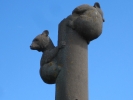
PICTURES/Grand Marais/t_Bear Totem2.jpg
The bear totem is probably the second most photographed site in Grand Marais
PICTURES/Grand Marais/t_Bear totem1.jpg
Cute little bear butt
PICTURES/Grand Marais/t_Bookstore4.JPG
Just a local book store
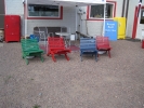
PICTURES/Grand Marais/t_Colorful Charis2.jpg
Artsy colorful chairs
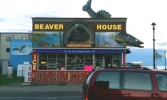
PICTURES/Grand Marais/t_Beaver House.jpg
The Beaver House may not be on the historical register, but it is very Grand Marais. That big fish give the fishing report and weather
PICTURES/Grand Marais/t_Ducks3.JPG
Ah Yes, more wildlife. Ducks
PICTURES/Grand Marais/t_Big Duck2.JPG
This guy had a wonderful expression
PICTURES/Grand Marais/t_Seagull On Chimmney.JPG
I just wonder what bird poop does to chimneys


Split Rock Lighthouse 08/06/2013

The Split Rock Lighthouse was on Brians wish list, so we stopped on our way to Grand Marais. It was constructed in 1910 and closed in 1969. I love their motto

BEFORE THERE WAS GPS THERE WAS A REALLY BIG LIGHT

Yup, that is Split Rock Lighthouse.

It was active until 1969. Thankfully it is in good hands and has been well maintained.

The lighthouse is fun to visit, and the surrounding paths and compound are worth the time.


PICTURES/Split Rock Lighthouse - Two Harbors MN/t_Split Rock Lighthouse Sign.JPG
Split Rock Lighthouse Sign
PICTURES/Split Rock Lighthouse - Two Harbors MN/t_Lighthouse Complex3.JPG
The lighthouse complex
PICTURES/Split Rock Lighthouse - Two Harbors MN/t_3rd Order Fresnel Lens1.JPG
A view of the 3rd Order Fresnel Lens
PICTURES/Split Rock Lighthouse - Two Harbors MN/t_3rd Order Fresnel Lens5.JPG
More of the lens housing
PICTURES/Split Rock Lighthouse - Two Harbors MN/t_Down Spiral Stair3.JPG
Looking down the spiral staircase from the top of the lighthouse
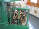
PICTURES/Split Rock Lighthouse - Two Harbors MN/t_Mirror Motor1.jpg
Part of the motor that turns the lens
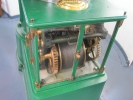
PICTURES/Split Rock Lighthouse - Two Harbors MN/t_MIrror Motor2.jpg
Another view of the motor
PICTURES/Split Rock Lighthouse - Two Harbors MN/t_Lantern1.JPG
The lantern from the observation deck outside the tower
PICTURES/Split Rock Lighthouse - Two Harbors MN/t_Lantern2.JPG
Action shot - well, not really but it is turning
PICTURES/Split Rock Lighthouse - Two Harbors MN/t_Keepers Cottages3.JPG
The Keepers Cottages
PICTURES/Split Rock Lighthouse - Two Harbors MN/t_Thru Trees3.JPG
The lighthouse from one of the trails
PICTURES/Split Rock Lighthouse - Two Harbors MN/t_Headland.JPG
One of the headlands near the lighthouse
PICTURES/Split Rock Lighthouse - Two Harbors MN/t_Lighthouse On Rocks5.JPG
The lighthouse from down on the beach
PICTURES/Split Rock Lighthouse - Two Harbors MN/t_Lighthouse Tower3.JPG
A shot of the lighthouse tower
PICTURES/Split Rock Lighthouse - Two Harbors MN/t_Point5.JPG
Can you feel the Kodak Moment?
PICTURES/Split Rock Lighthouse - Two Harbors MN/t_On Beach With LH As Background3.JPG
Down on the beach, or what passes for the beach at this point.
PICTURES/Split Rock Lighthouse - Two Harbors MN/t_Stairs - Going Down2.JPG
Going down the stairs to the lower sections
PICTURES/Split Rock Lighthouse - Two Harbors MN/t_Stairs - Looking Up1.JPG
Which means you have to go back up the stairs.


Cascade Falls - Cascade River State Park MN 08/09/2013

On the way back to the Twin Cities we did a couple stops.

The first was at Cascade Falls.

It is just a short walk to the falls, and the path around it is a nice break from the car.


PICTURES/Cascade Falls - Cascade River State Park MN/t_Cascade Falls Sign.JPG
Love the sign
PICTURES/Cascade Falls - Cascade River State Park MN/t_Cascade Falls7.jpg
The falls from the bridge
PICTURES/Cascade Falls - Cascade River State Park MN/t_Under Catwalk.JPG
The catwalk over the river on the trail
PICTURES/Cascade Falls - Cascade River State Park MN/t_Bridge at Cascade Falls4.JPG
The bridge down on the river
PICTURES/Cascade Falls - Cascade River State Park MN/t_Cascade Falls5.jpg
Lots of rocks
PICTURES/Cascade Falls - Cascade River State Park MN/t_Cascade Falls6.jpg
More water
PICTURES/Cascade Falls - Cascade River State Park MN/t_Lumpy Tree at Cascade Falls1.jpg
We loved this lumpy tree


Gooseberry Falls - Gooseberry Falls State park MN 08/09/2013

Gooseberry Falls is probably the most visited of all the falls along Route 61.

When we first stopped there, way back in 1993, you parked along the road and went down a dirt path to some nice wooden overlooks, or scrambled down the hill to the water.

Now it is all gussied up with paved walks, parking lots, huge visitors center.

We liked it better the old way, but the falls are still pretty.


PICTURES/Gooseberry Falls - Gooseberry Falls State Park MN/t_Gooseberry Falls Sign.JPG
Nice endowment gets you a visitors center
PICTURES/Gooseberry Falls - Gooseberry Falls State Park MN/t_Gooseberry Falls20.JPG
It is hard to get a shot of the falls withougt people in it
PICTURES/Gooseberry Falls - Gooseberry Falls State Park MN/t_Gooseberry Falls6.JPG
If you look closely you can see some kids on the other side of the water. Pretty high up
PICTURES/Gooseberry Falls - Gooseberry Falls State Park MN/t_Gooseberry Falls Bridge1.JPG
The bridge down at the bottom
PICTURES/Gooseberry Falls - Gooseberry Falls State Park MN/t_Gooseberry Falls9.jpg
It is hard to get a shot without people in it
PICTURES/Gooseberry Falls - Gooseberry Falls State Park MN/t_Artsy Trees at Gooseberry2.JPG
Artsy tree roots.
PICTURES/Gooseberry Falls - Gooseberry Falls State Park MN/t_Gooseberry Falls4.JPG
This has a nice shot of the bridge
PICTURES/Gooseberry Falls - Gooseberry Falls State Park MN/t_Gooseberry Falls24.JPG
It runs pretty fast


Caponi Art Park and Learning Center - Eagan MN 08/14/2013

All those years we lived right next door in Apple Valley we never knew this park existed. Too bad because it is a wonderful place to visit.

It is 60 acres of art and entertainment. Over the years Mr. Caponi has created some impressive pieces and put them on display for the public to enjoy for free.

During summer there are events at the outdoor theater which is nestled among the trees.

Every path takes you to something interesting. All the art is organic in nature, a mixture of nature and man.

We want to go back and enjoy this again on our next visit.


PICTURES/Caponi Art Park and Learning Center - Eagan MN/t_Anchor & Stone.jpg
OK, I do not remember the names of the pieces so I am making them up - anchor and stone
PICTURES/Caponi Art Park and Learning Center - Eagan MN/t_Birds2.JPG
Obviously birds
PICTURES/Caponi Art Park and Learning Center - Eagan MN/t_BLock1.jpg
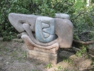
No idea but the organic mix of stones is interesting
PICTURES/Caponi Art Park and Learning Center - Eagan MN/t_Brother & Sister.jpg
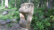
Mother and child or Brother and sister
PICTURES/Caponi Art Park and Learning Center - Eagan MN/t_Bug1.JPG
Artsy bug shot in flower
PICTURES/Caponi Art Park and Learning Center - Eagan MN/t_Conglomerate.jpg
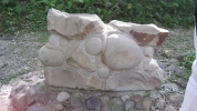
Yes, this conglomerate had meaning
PICTURES/Caponi Art Park and Learning Center - Eagan MN/t_Mouth.JPG
I call this the mouth
PICTURES/Caponi Art Park and Learning Center - Eagan MN/t_Dinasaur.jpg
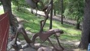
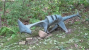
Dinasaur
PICTURES/Caponi Art Park and Learning Center - Eagan MN/t_Grecian Head.JPG
The Grecian Head is embedded in the wall by the outdoor theater
PICTURES/Caponi Art Park and Learning Center - Eagan MN/t_Horse1.jpg
Horse
PICTURES/Caponi Art Park and Learning Center - Eagan MN/t_Lost Head.JPG
Flashback to Lord of the Rings and Parth Galen.
PICTURES/Caponi Art Park and Learning Center - Eagan MN/t_Mantis3.jpg
Praying Mantis
PICTURES/Caponi Art Park and Learning Center - Eagan MN/t_Monument to Lumberjack1.jpg
Monument to Lumberjacks. Yes, those are real saws
PICTURES/Caponi Art Park and Learning Center - Eagan MN/t_Cornerstone1.jpg
Cornerstone. It has very intricate detail
PICTURES/Caponi Art Park and Learning Center - Eagan MN/t_Snake1.JPG
The Snake
PICTURES/Caponi Art Park and Learning Center - Eagan MN/t_Snake2.JPG
The detail is amazing
PICTURES/Caponi Art Park and Learning Center - Eagan MN/t_Mother & Child2.jpg
This is one of the oldest pieces. It is deteriorating from the weather and has been moved to a more sheltered spot
PICTURES/Caponi Art Park and Learning Center - Eagan MN/t_P1160698.JPG
Often you see several pieces from one vantage point. At other times you walk a path to see a single sculpture
PICTURES/Caponi Art Park and Learning Center - Eagan MN/t_Points & Rocks2.jpg
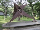
Point and rocks. Everything is a mix of natural elements and often metal
PICTURES/Caponi Art Park and Learning Center - Eagan MN/t_Shrooms2.JPG
Shrooms. This was a haven for mushrooms, and you know we love shrooms
PICTURES/Caponi Art Park and Learning Center - Eagan MN/t_Slab2.jpg
A totem


Mount Evans and The Highest Paved Road in N.A - Denver CO 08/16/2013

When we were heading home from Minnesota we wanted to do at least one or two tourist stops.

We decided to travel through Colorado, and while looking at our atlas I saw this little road marked as "the longest paved road" just outside of Denver.

Now this sounded intriguing so we adjusted our route and times so we would get to it a bit after lunch.

This should be no surprise that there is copious roadwork around the Denver area, and we had a little bit of trouble finding the road, but eventually we did and started our drive up the mountain.

The top of Mount Evans is at 14,130 feet and the road up is a fairly well maintained but narrow 2 laner.

There are many places to see, such as the Bristlecone Pines at Mount Goliath Natural area. These are old, up to 1,700 years old.

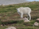
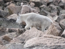
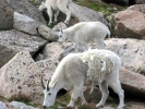
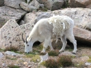
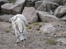
Once above the tree line you get to enjoy Mountain Goats. I have never been 3 feet from a Mountain Goat but they were everywhere.

We stepped out of our truck to watch them on several occasions. They were even at the top.

There are also lots of Big Horn Sheep, Golden Mantled Ground Squirrels, Yellow Bellied Marmots and more.

A plethora of wildlife. What an amazing find.


PICTURES/Mount Evans and The Highest Paved Road in N.A - Denver CO/t_Bristlecone Pine4.JPG
Our first stop was at Mount Goliath Natural area where we saw the Bristlecone Pines
PICTURES/Mount Evans and The Highest Paved Road in N.A - Denver CO/t_Bristlecone Pine7.JPG
Unfortunately we did not have time to fully enjoy this whole section
PICTURES/Mount Evans and The Highest Paved Road in N.A - Denver CO/t_Bog6.JPG
Farther up the mountain at Echo Lake there were these wonderful bogs
PICTURES/Mount Evans and The Highest Paved Road in N.A - Denver CO/t_Bog2.JPG
I do not think we wer able to capture the lushness of the vegetation
PICTURES/Mount Evans and The Highest Paved Road in N.A - Denver CO/t_Goat14.JPG
Further up the mountain we came upon the Mountain Goats. Just walking along the road, feeding on the grass
PICTURES/Mount Evans and The Highest Paved Road in N.A - Denver CO/t_Goat2.jpg
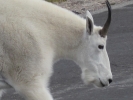
What a beautiful animal
PICTURES/Mount Evans and The Highest Paved Road in N.A - Denver CO/t_Goat3.jpg
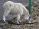
As you can see they are shedding. He uses the pole to help strip off unwanted coat
PICTURES/Mount Evans and The Highest Paved Road in N.A - Denver CO/t_Goat5.jpg
A baby goat
PICTURES/Mount Evans and The Highest Paved Road in N.A - Denver CO/t_Goat9.jpg
Classic shot of goat in rocks
PICTURES/Mount Evans and The Highest Paved Road in N.A - Denver CO/t_Goat11.jpg
Nibbling
PICTURES/Mount Evans and The Highest Paved Road in N.A - Denver CO/t_Goat Family8.JPG
Just a group grazing
PICTURES/Mount Evans and The Highest Paved Road in N.A - Denver CO/t_Goat Shaggy.jpg
You really see the molting on this one
PICTURES/Mount Evans and The Highest Paved Road in N.A - Denver CO/t_Goat23.JPG
Another classic pose
PICTURES/Mount Evans and The Highest Paved Road in N.A - Denver CO/t_Goat28.JPG
The coats actually glisten
PICTURES/Mount Evans and The Highest Paved Road in N.A - Denver CO/t_Road Shot2.JPG
A shot of the road going up the mountain
PICTURES/Mount Evans and The Highest Paved Road in N.A - Denver CO/t_Road To Nowhere.JPG
It can be a little hairy on some of the blind turns
PICTURES/Mount Evans and The Highest Paved Road in N.A - Denver CO/t_Goat Family1.jpg
More goats. We took a lot of goat pictures
PICTURES/Mount Evans and The Highest Paved Road in N.A - Denver CO/t_Mt. Evans Road Sign.JPG
Finally got to the top
PICTURES/Mount Evans and The Highest Paved Road in N.A - Denver CO/t_Top of Mt. Evans1.JPG
Pulling into the parking lot at 14,00 feet. The top is another 130 foot walk
PICTURES/Mount Evans and The Highest Paved Road in N.A - Denver CO/t_Winding Road3.JPG
Looking back at the winding road we took getting up here
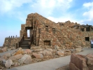
PICTURES/Mount Evans and The Highest Paved Road in N.A - Denver CO/t_Crest House1.jpg
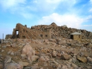
Our first view of Crest House. Once it was a restaurant and gift shop, but it burned in 1979. The foundation is now stable and you can explore it
PICTURES/Mount Evans and The Highest Paved Road in N.A - Denver CO/t_Top of Mt Evans.jpg
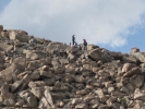
Looking up to the folks already on the top of Mount Evans
PICTURES/Mount Evans and The Highest Paved Road in N.A - Denver CO/t_Goat Family4.JPG
Inside Crest House we saw this mother and baby goat
PICTURES/Mount Evans and The Highest Paved Road in N.A - Denver CO/t_Goat Family5.JPG
Give you some idea of where they are in relation to the people looking at the interior of the building
PICTURES/Mount Evans and The Highest Paved Road in N.A - Denver CO/t_Path to top.JPG
Walking up to the top. Take it easy because at this altitude you can get a little dizzy.
PICTURES/Mount Evans and The Highest Paved Road in N.A - Denver CO/t_George near summit.jpg
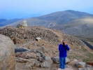
George near the top with Crest House in the background
PICTURES/Mount Evans and The Highest Paved Road in N.A - Denver CO/t_Sharon at top.JPG
I'm on top. Yeah me
PICTURES/Mount Evans and The Highest Paved Road in N.A - Denver CO/t_Crest House from summit.jpg
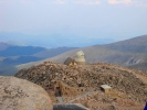
Looking back at Crest House and the Meyer-Womble Observatory built by U of Denver in 1976
PICTURES/Mount Evans and The Highest Paved Road in N.A - Denver CO/t_Grand View1.jpg
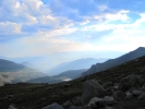
On our way down we stopped to shoot some of the grand views we saw
PICTURES/Mount Evans and The Highest Paved Road in N.A - Denver CO/t_Grand View4.jpg
It was pretty overcast thanks to the wildfires burning in Idaho
PICTURES/Mount Evans and The Highest Paved Road in N.A - Denver CO/t_Grand View7.JPG
Alpine meadows
PICTURES/Mount Evans and The Highest Paved Road in N.A - Denver CO/t_Ground Squirrel1.JPG
A Golden Mantled Ground Squirrel
PICTURES/Mount Evans and The Highest Paved Road in N.A - Denver CO/t_Ground Squirrel4.JPG
Enjoying a little snack
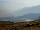
PICTURES/Mount Evans and The Highest Paved Road in N.A - Denver CO/t_Rocky Hill3.JPG
The rocky hills are covered with low but lush vegetation
PICTURES/Mount Evans and The Highest Paved Road in N.A - Denver CO/t_Marmet1.JPG
Our Yellow Bellied Marmot. We were not sure at first because the only marmots we had seen to date were in Glacier, and those were huge
PICTURES/Mount Evans and The Highest Paved Road in N.A - Denver CO/t_Marmet7.JPG
Classic Marmot pose
PICTURES/Mount Evans and The Highest Paved Road in N.A - Denver CO/t_Raven4.JPG
Great raven.
PICTURES/Mount Evans and The Highest Paved Road in N.A - Denver CO/t_Raven5.JPG
I will not show you what he was eating. Great example of evisceration - boys would love it
PICTURES/Mount Evans and The Highest Paved Road in N.A - Denver CO/t_Road Shot3.JPG
Road going down
PICTURES/Mount Evans and The Highest Paved Road in N.A - Denver CO/t_Rocky Hill1.JPG
More rocky hillsides
PICTURES/Mount Evans and The Highest Paved Road in N.A - Denver CO/t_Summit Lake2.JPG
That is Echo Lake below
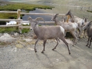
PICTURES/Mount Evans and The Highest Paved Road in N.A - Denver CO/t_Sheep2.jpg
We found Mountain Sheep at Echo Lake.
PICTURES/Mount Evans and The Highest Paved Road in N.A - Denver CO/t_Sheep4.JPG
Must have butt shots
PICTURES/Mount Evans and The Highest Paved Road in N.A - Denver CO/t_Sheep6.JPG
Coming back
PICTURES/Mount Evans and The Highest Paved Road in N.A - Denver CO/t_Sheep8.JPG
If one heads back, they all do
PICTURES/Mount Evans and The Highest Paved Road in N.A - Denver CO/t_Sun Through Smoke1.JPG
The sun as seen through smoke from the Idaho fires


Fort Garland Museum - Fort Garland CO 08/17/2013

We love old forts. It does not matter what they were used for, what condition they are now in, or just how far off the beaten path they are we will go to see them. Sometimes there is not much left, but quite often we are so pleasantly surprised by what has been preserved, restored and recreated. Fort Garland was one of those finds.

Located about 50 miles west of I-15 on US-160 there is not much besides open country until you get into the small town of Fort Garland. For such a small town the museum is quite large, and there have been many active, thorough digs throughout the years that have unearthed a great trove of artifacts related to the area and the fort. These are well displayed in the various buildings s they relate to their use during those times.

They have also done a good job in delineating what is original and what has been restored. Nicely done. Since we have listened to the life of Kit Carson we were a bit familiar with the importance of this fort, so it was nice to see it is so well maintained and cared for. Any fort or history enthusiast would do well to take the time for a visit here.


PICTURES/Fort Garland Museum - Fort Garland CO/t_Museum.jpg
The exit from what is now the office and gift shop
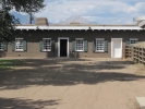
PICTURES/Fort Garland Museum - Fort Garland CO/t_Infantry Barracks.JPG
Infantry Barracks
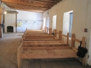
PICTURES/Fort Garland Museum - Fort Garland CO/t_Barracks7.jpg
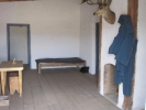
Inside infantry barracks
PICTURES/Fort Garland Museum - Fort Garland CO/t_Infantry Barracks2.JPG
Infantry barracks again
PICTURES/Fort Garland Museum - Fort Garland CO/t_Calvary Barracks.JPG
Calvary barracks
PICTURES/Fort Garland Museum - Fort Garland CO/t_Barracks4.JPG
Inside Calvary Barracks.
PICTURES/Fort Garland Museum - Fort Garland CO/t_Barracks6.JPG
A bit different in decor
PICTURES/Fort Garland Museum - Fort Garland CO/t_Commandants Quarters.JPG
Commandants Quarters
PICTURES/Fort Garland Museum - Fort Garland CO/t_Commandants Dinning Room2.JPG
Commandants Dinning Room
PICTURES/Fort Garland Museum - Fort Garland CO/t_Commandants Dinning Room.JPG
Love the antler sculpture
PICTURES/Fort Garland Museum - Fort Garland CO/t_Commandants Kitchen.JPG
Commandants kitchen
PICTURES/Fort Garland Museum - Fort Garland CO/t_Commandants Quarters Door.JPG
A shot of a door. Notice the thickness of the inner walls
PICTURES/Fort Garland Museum - Fort Garland CO/t_Commandants Quarters Hall4.JPG
Commandants hall - must have served as a waiting room as well
PICTURES/Fort Garland Museum - Fort Garland CO/t_Commandants Quarters5.JPG
Another outside shot of the Commandants Quarters
PICTURES/Fort Garland Museum - Fort Garland CO/t_Parade Ground6.JPG
The flagpole on the parade ground is nautical. Choosen specifically back then to withstand the high winds here
PICTURES/Fort Garland Museum - Fort Garland CO/t_Guard House1.jpg
The Guard House
PICTURES/Fort Garland Museum - Fort Garland CO/t_Guard House4.JPG
Gueard House
PICTURES/Fort Garland Museum - Fort Garland CO/t_Officers Quarters2.JPG
Officers Quarters
PICTURES/Fort Garland Museum - Fort Garland CO/t_Officers Quarters.jpg
Another shot of Officers Quarters
PICTURES/Fort Garland Museum - Fort Garland CO/t_Theater4.JPG
One of the buildings substituted as a theater then and is still in use today
PICTURES/Fort Garland Museum - Fort Garland CO/t_Theater7.JPG
The beams and supports are quite substantial
PICTURES/Fort Garland Museum - Fort Garland CO/t_Theater9.jpg
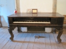
The piano in the theater